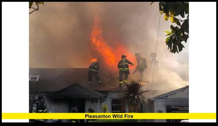

The wildfire burning near Pleasanton in Alameda County has become one of the most significant vegetation fire incidents in the East Bay this week. Officially named the Little Fire, the blaze spread rapidly through dry grasslands shortly after it was reported, triggering evacuation orders, road closures, and a large emergency response involving local, regional, and state firefighting resources.
As flames advanced across open terrain southeast of Pleasanton near Sunol, emergency officials acted quickly to protect nearby communities while aircraft and ground crews worked to slow the fire’s progression. The incident has drawn widespread attention because of its proximity to residential neighborhoods and transportation corridors, highlighting the wildfire risks that continue to affect Northern California during the summer fire season.
A Fast-Moving Grass Fire in Alameda County
The Little Fire ignited in the rural hills near the intersection of Vallecitos Road and Little Valley Road, an area known for expansive grasslands and rolling terrain. These landscapes can become highly vulnerable during prolonged periods of hot, dry weather when vegetation loses moisture and ignites easily.
Fire crews responding to the initial reports found flames spreading quickly across dry grass. The combination of warm temperatures, low humidity, and occasional afternoon winds allowed the fire to grow at a rapid pace before firefighters could establish containment lines.
Within a relatively short time, smoke from the incident became visible across much of the Tri-Valley region, with residents in Pleasanton, Livermore, Dublin, Fremont, and neighboring communities observing a large smoke plume rising above the hills.
Current Fire Size and Status
According to the latest official information available today, the wildfire expanded to approximately 700 acres during its initial growth.
Firefighters continue working to improve containment while protecting structures located near threatened areas. Although fire conditions can change throughout the day depending on weather and terrain, emergency officials have reported that suppression efforts remain active.
At the latest update:
- The fire has burned roughly 700 acres.
- Numerous fire engines remain assigned.
- Aircraft continue supporting operations when conditions allow.
- Bulldozers and hand crews are reinforcing containment lines.
- No fatalities have been officially reported.
- No widespread destruction of homes has been officially confirmed.
- The cause of the wildfire remains under investigation.
Containment percentages may continue to change as crews gain access to different portions of the fire perimeter and evaluate remaining hot spots.
Massive Emergency Response
The scale of the response reflects the seriousness of the incident. Fire agencies mobilized resources from across the region almost immediately after the fire was reported.
The response includes:
- Structural fire engines
- Wildland fire engines
- Water tenders
- Hand crews
- Bulldozers
- Air tankers
- Water-dropping helicopters
- Incident management personnel
- Law enforcement officers assisting with evacuations
Aircraft have played an especially important role in slowing the advance of the fire. Helicopters repeatedly collected water from nearby sources before making drops over active flames, while fixed-wing air tankers laid fire retardant along strategic locations to reduce fire spread.
Ground firefighters followed behind these aerial operations to strengthen containment lines and extinguish remaining hot spots.
Evacuation Orders Issued to Protect Residents
As the fire expanded toward populated areas, emergency officials issued evacuation orders for neighborhoods considered to be under immediate threat.
Among the communities receiving evacuation instructions was the Ruby Hill area, one of Pleasanton’s most recognized residential neighborhoods.
Residents in evacuation zones were instructed to leave immediately and avoid delaying departure while firefighters conducted structure protection operations.
Officials also established evacuation warning areas surrounding the active fire. These warnings advised residents to prepare for the possibility of mandatory evacuation if conditions worsened.
Evacuation decisions are based on continuously changing fire behavior, weather conditions, and projected fire movement. Authorities emphasized that public cooperation is essential because delayed evacuations can create additional hazards for both residents and emergency responders.
Temporary shelters and assistance resources were made available for displaced individuals while emergency personnel coordinated public safety operations.
Communities Affected by the Fire
Although the wildfire originated in a rural area, its impacts extended across several East Bay communities.
Areas directly or indirectly affected include:
- Pleasanton
- Sunol
- Ruby Hill
- Vallecitos Road corridor
- Little Valley Road
- Eastern Alameda County
Residents outside evacuation zones also experienced reduced air quality, visible smoke, and increased emergency vehicle activity throughout the region.
Many schools, businesses, and commuters monitored official updates as the incident developed.
Weather Conditions Fueled Rapid Growth
The environmental conditions present during the incident significantly contributed to the wildfire’s rapid expansion.
Several factors increased fire danger:
- Extremely dry annual grasses
- High daytime temperatures
- Low humidity
- Periodic wind gusts
- Continuous vegetation across open hillsides
Grass fires differ from heavily wooded forest fires because they often spread at remarkable speed. Flames can race through dry fields in minutes, especially when aided by changing winds.
Even relatively small wind shifts may redirect fire movement, requiring firefighters to constantly adjust suppression strategies.
These challenging conditions required continuous monitoring from both ground personnel and aerial observation teams.
Smoke Spread Across the East Bay
One of the most noticeable effects of the wildfire has been the large smoke column visible throughout much of the Bay Area.
Residents reported seeing smoke from numerous surrounding cities, including:
- Livermore
- Dublin
- Fremont
- San Ramon
- Castro Valley
- Oakland in more distant areas
Smoke conditions varied throughout the day depending on wind direction.
Health officials generally advise individuals with asthma, heart disease, or other respiratory conditions to reduce prolonged outdoor activity whenever wildfire smoke significantly affects local air quality.
Parents of young children and older adults are also encouraged to monitor changing conditions during active wildfire events.
Read More – Pleasanton Fire Map: Live Evacuation Areas, Fire Perimeter, and Latest Updates
Road Closures and Transportation Impacts
Emergency operations temporarily affected transportation throughout southeastern Alameda County.
Road closures and traffic restrictions were implemented in several locations to provide safe access for firefighting equipment and evacuation traffic.
Motorists encountered:
- Restricted road access
- Temporary closures
- Heavy emergency vehicle traffic
- Controlled entry into evacuation areas
Authorities urged drivers to avoid unnecessary travel near the incident, helping emergency crews move efficiently between active fire locations.
Residents were reminded that road closures can remain in place even after visible flames decrease because firefighting equipment continues operating throughout the affected area.
Protecting Homes and Critical Infrastructure
As flames approached developed areas, firefighters shifted significant resources toward protecting homes and important infrastructure.
Structure protection efforts included positioning fire engines throughout vulnerable neighborhoods while crews monitored for embers capable of igniting roofs, landscaping, fences, or outbuildings.
Additional protective actions involved:
- Clearing vegetation around threatened structures
- Applying water to exposed areas
- Monitoring spot fires
- Patrolling neighborhoods after flame fronts passed
- Evaluating damage risks throughout the incident
These operations are often among the most labor-intensive aspects of wildfire response because firefighters must balance direct fire suppression with protecting lives and property.
At the latest official update, no widespread structural losses had been confirmed.
Investigation Into the Cause Continues
Investigators have not yet announced what started the Little Fire.
Determining the origin of a wildfire requires careful examination of the ignition area after conditions become safe for investigators to enter.
Wildfire investigations commonly evaluate numerous possible causes, including:
- Human activity
- Equipment operation
- Vehicles
- Electrical infrastructure
- Natural ignition sources
Until the investigation is completed, officials have not attributed the fire to any specific cause.
Residents are encouraged to rely on verified information while investigators continue their work.
Why Grass Fires Can Spread So Quickly
Unlike forest fires that often move through dense timber, grass fires typically travel across fine fuels that ignite almost instantly.
Dry grasses burn intensely and allow flames to advance rapidly across open terrain. Wind further accelerates this process by carrying flames toward unburned vegetation while also transporting burning embers ahead of the main fire.
This combination creates additional spot fires that may ignite well beyond the primary fire front.
Because of these characteristics, firefighters often rely on aggressive aerial suppression combined with extensive ground operations during major grass fires.
Community Preparedness During Fire Season
The wildfire serves as another reminder that East Bay communities remain vulnerable during California’s peak wildfire season.
Emergency officials continue encouraging residents to prepare well before emergencies occur by:
- Keeping emergency supply kits ready
- Maintaining defensible space around homes
- Registering for local emergency alerts
- Preparing family evacuation plans
- Knowing multiple evacuation routes
- Staying informed through official emergency announcements
Preparedness allows families to respond more quickly if evacuation orders become necessary.
Latest Situation
Firefighters remain focused on strengthening containment lines and monitoring weather conditions that could influence fire behavior.
Current official information indicates:
- Approximately 700 acres have burned.
- Aircraft and ground crews continue suppression efforts.
- Evacuation orders remain an important safety measure for affected areas.
- No official fatalities have been reported.
- No widespread destruction of residential structures has been confirmed.
- The wildfire investigation remains ongoing.
Emergency officials will continue evaluating fire conditions while updating residents as containment improves.
Looking Ahead
Although significant progress has been made in slowing the wildfire’s advance, firefighting operations remain active as crews work toward full containment. The incident demonstrates how rapidly vegetation fires can develop during Northern California’s dry summer months and why coordinated emergency response remains essential for protecting communities.
Residents throughout Pleasanton and neighboring areas are encouraged to remain alert for changing conditions, especially if weather patterns shift or additional evacuation information becomes necessary. As firefighters continue their work, public cooperation and awareness remain important components of the overall emergency response.
Stay connected for the latest developments, and feel free to share your thoughts or local updates in the comments as the situation continues to evolve.