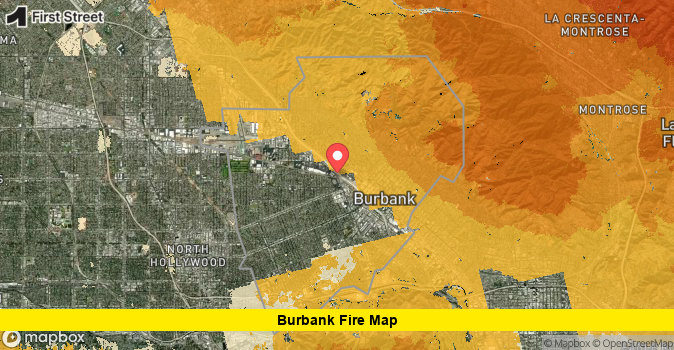

Residents searching for a Burbank fire map are looking for the latest details on the Walnut Fire, a brush fire that broke out on a hillside above Burbank on August 8, 2026, and prompted evacuation orders for homes and businesses near Wildwood Canyon. Crews have made significant progress overnight, and containment lines are holding as cleanup and monitoring continue into Sunday.
The fire ignited in the 1500 block of East Walnut Avenue, near the intersection of East Harvard Road and Wildwood Canyon Road, an area close to DeBell Golf Course and popular hiking trails above the city. Firefighters, along with aircraft dropping water on the hillside, responded quickly, and the blaze has since been given the official name the Walnut Fire.
What Sparked the Walnut Fire
The Walnut Fire was first reported shortly before 3:10 p.m. on Saturday, August 8, 2026, in the hills above Burbank. A vehicle crash was reported nearby at 1200 East Harvard Road just minutes before the fire broke out, though it remains unconfirmed whether the crash is connected to the ignition. Fire officials have not released a confirmed cause, and the investigation into how the fire started is ongoing.
Within the first hour, the fire had grown to an estimated 20 acres. By early evening, updates from Burbank city officials placed the fire’s size closer to 40 acres, with containment reaching approximately 70 percent as crews worked through the night to reinforce fire lines around the perimeter.
Where the Fire Is Burning
The Walnut Fire is burning in the hillside terrain above Burbank, an area that includes several well-known local landmarks. The blaze is located near:
- DeBell Golf Course and the adjacent DeBell Restaurant
- Wildwood Canyon Park and its hiking trails
- Stough Canyon Nature Center
- The Castaway Restaurant, which served as a staging area for the Verdugo Fire Academy’s operations
- Country Club Drive and Churches Court, residential streets close to the burn area
High-end homes along Country Club Drive sit near the fire footprint, which is part of why the response escalated so quickly once flames were spotted on the hillside. Aerial footage from the scene showed helicopters making repeated water drops on the steep terrain throughout Saturday afternoon and evening.
Evacuation Orders and Closures
As the fire grew, the City of Burbank issued evacuation orders for the DeBell Restaurant and Golf Course as well as the Stough Canyon Nature Center. An evacuation warning, a step below a mandatory order, was issued for residents along Churches Court and Country Club Drive, asking them to be ready to leave if conditions worsened.
Public safety officials also closed all hiking trails in the area, including those in Wildwood Canyon, until further notice. The Starlight Bowl, an outdoor amphitheater located near the fire zone, canceled its scheduled Saturday night concert as a precaution.
By around 5 p.m., officials reported that the smoke plume over the hillside had dissipated significantly, a sign that water drops and ground crews were making measurable progress against the flames. Fire crews from the Burbank Fire Department were joined by regional partners, including U.S. Forest Service personnel, to strengthen the response.
Crews Make Progress Overnight
Firefighters continued working through the night to fully surround the fire and prevent any renewed spread. As of the most recent update, containment stood at roughly 70 percent, with the fire mapped at approximately 40 acres. Officials say fire hose lines remain in place around the perimeter to hold the containment gains made overnight.
Cleanup and monitoring operations are expected to continue through the day, with crews checking for hot spots in the steep, brush-covered terrain that can be difficult to access. Evacuation orders and warnings may be lifted in stages as containment improves, though residents in the affected area should continue checking official city and fire department channels for the latest status rather than relying on secondhand reports.
How to Follow the Burbank Fire Map
For the most accurate, real-time picture of the fire’s footprint, residents are encouraged to rely on official sources rather than social media rumors. The City of Burbank and the Burbank Fire Department have been posting regular updates on evacuation zones, road closures, and containment percentages. Cal Fire’s incident tracking tools also provide mapped perimeters for active wildfires across the region, which can help residents understand exactly how close the fire is to specific neighborhoods.
Given how quickly conditions changed on Saturday, from a reported ignition to evacuation orders within a short window, officials continue to stress the importance of having a personal evacuation plan ready. Burbank sits along a stretch of hillside communities where wildfire risk is elevated during dry summer months, and fire officials routinely encourage residents to prepare defensible space around their homes, keep emergency kits stocked, and know their evacuation routes in advance.
Why This Fire Drew Rapid Response
The Walnut Fire’s location near multiple public facilities and residential streets is likely why the response scaled up so fast. Golf courses, restaurants, and nature centers in the burn area meant officials needed to account for both public safety and property protection simultaneously. The presence of the Castaway Restaurant parking lot as a staging ground allowed Verdugo Fire Academy crews to coordinate operations close to the fire line, which may have helped speed up the initial attack.
Steep, brush-heavy terrain like that found in Wildwood Canyon can also make fires harder to access on foot, which is part of why aircraft played such a central role in the firefight. Helicopter water drops were credited with helping reduce the smoke plume and slow the fire’s forward spread during the critical early hours.
Final Thoughts
The Walnut Fire on the Burbank hillside has moved from a fast-growing brush fire on Saturday afternoon to a largely contained incident by Sunday, thanks to a rapid multi-agency response and favorable overnight conditions. While containment has reached approximately 70 percent and evacuation orders have started to ease in some areas, officials caution that mop-up work is still underway and conditions can shift, particularly in dry hillside terrain prone to wind-driven spread.
Anyone living near Wildwood Canyon, DeBell Golf Course, or Country Club Drive should continue monitoring official Burbank city and fire department updates for the latest evacuation status. As firefighters wrap up containment efforts, the coming days will likely bring more clarity on the fire’s official size, cause, and any impact on nearby structures.
Stay tuned for continued updates on the Walnut Fire and share your thoughts in the comments below.