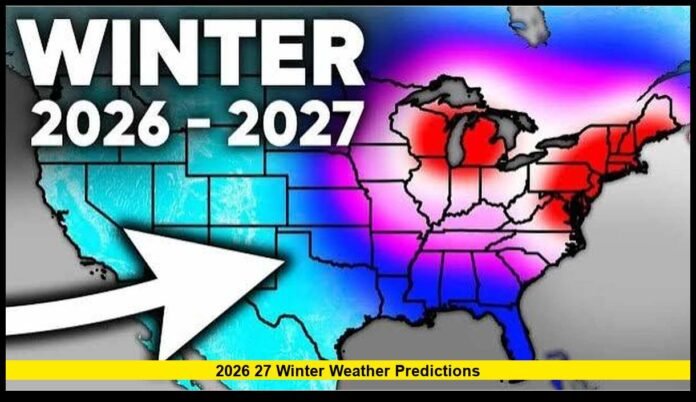

The 2026–27 winter weather predictions point to a potentially active season across the U.S., with shifting patterns in snowfall, cold temperatures, and regional weather conditions.
Winter may still be months away, but interest in 2026 27 winter weather predictions is already building as millions of Americans prepare for another season of changing weather conditions. Long-range climate outlooks indicate that several large-scale atmospheric patterns could influence temperatures, precipitation, and snowfall during the upcoming winter. While seasonal forecasting cannot pinpoint the exact timing or location of individual storms, it can provide a useful overview of the conditions that are more likely to develop across different regions of the country.
Why Seasonal Winter Forecasts Matter
Long-range winter outlooks are valuable because they give families, businesses, farmers, transportation agencies, utility providers, and outdoor recreation industries time to prepare for possible weather patterns months in advance. For the 2026–27 winter, NOAA’s Climate Prediction Center is closely monitoring a strengthening El Niño, which is expected to influence U.S. temperature and precipitation patterns through the winter.
Unlike a seven-day forecast, a seasonal outlook does not attempt to predict the exact temperature, snowfall amount, or timing of individual storms. Instead, meteorologists estimate whether average temperatures and precipitation are more likely to fall above, near, or below normal over three-month periods. NOAA’s outlooks use climate signals including ocean temperatures, atmospheric circulation, historical patterns, statistical methods, and multiple computer forecast models.
Current guidance suggests that El Niño could become an important factor during the 2026–27 winter, potentially increasing precipitation chances across parts of the southern United States while influencing temperature patterns across other regions. However, these broad signals cannot determine where individual snowstorms will develop or how much snow a particular city will receive.
Therefore, seasonal forecasts should be treated as probabilistic guidance rather than guarantees. NOAA updates its outlooks regularly as new observations and model information become available, making later forecasts increasingly useful as winter approaches.
Climate Patterns Are Becoming More Important
Several large-scale climate influences are expected to shape the 2026–2027 winter weather outlook, with El Niño now the dominant climate signal being monitored by forecasters. NOAA’s latest July 2026 assessment says El Niño has strengthened and is expected to continue through early 2027, with a 97% chance of persistence into early spring.

El Niño develops when sea-surface temperatures become unusually warm across the central and eastern tropical Pacific. Those ocean-temperature changes can influence atmospheric circulation far beyond the Pacific, including the position and strength of the jet stream. In turn, changes in the jet stream can affect storm tracks, moisture distribution, and the frequency with which colder Arctic air moves into the continental United States.
For the upcoming winter, NOAA’s seasonal guidance already incorporates the expected influence of El Niño, while noting that its effects vary considerably by region. The latest outlook favors above-normal temperatures across much of the West and northern United States during the broader October 2026–January 2027 period, while parts of the southern tier have lower-confidence temperature signals.
However, El Niño does not determine every snowstorm, cold wave, or winter storm. Short-term atmospheric patterns, blocking systems, the Arctic Oscillation, North Atlantic Oscillation, and other factors can temporarily override the broader seasonal signal. As a result, climate patterns provide an important framework for understanding 2026–27 winter weather predictions, but they cannot reliably pinpoint individual storms months in advance.
Temperature Outlook Across the United States
Current climate guidance indicates that temperatures during the 2026–27 winter could vary significantly across the United States, with regional differences becoming increasingly important as the season approaches. NOAA’s latest outlooks are being shaped in part by a strengthening El Niño, which is expected to continue into early 2027.
Northern States
Much of the northern United States may experience temperatures that trend warmer than the long-term average over portions of the winter. However, a warmer seasonal average does not mean winter conditions will disappear. Individual cold outbreaks can still produce sharply lower temperatures, snow, ice, and dangerous wind chills.
Residents could see:
- Alternating periods of mild and cold weather
- Short-lived Arctic air outbreaks
- Rapid temperature changes behind passing storm systems
- Periods when rain, snow, and freezing precipitation occur close together
- Fewer sustained stretches of extreme cold in some areas
The important distinction is between seasonal averages and individual weather events. Even if temperatures average above normal, a powerful cold-air intrusion can still create several days of severe winter conditions.
Southern States
The southern United States may have a different winter pattern, particularly because El Niño can influence the subtropical jet stream and storm track. Current climate signals favor the possibility of more active precipitation patterns across portions of the southern tier, although conditions will not be identical from Texas to Florida or across the interior South.
Potential conditions include:
- More frequent rain-producing storm systems
- Periodic cooler weather following strong fronts
- Occasional severe thunderstorms
- Increased opportunities for wintry precipitation across northern parts of the South
- Significant variations between individual states and cities
Importantly, an active storm pattern does not automatically mean widespread snow. Snowfall depends on whether sufficiently cold air is present when storms arrive. As winter gets closer, shorter-range forecasts will provide a much clearer picture of individual cold waves and snow or ice events.
Snowfall Outlook Remains Highly Variable
Predicting total seasonal snowfall remains one of the most challenging parts of the 2026–27 winter weather outlook. While large-scale climate patterns such as El Niño can provide clues about where precipitation may be more likely, they cannot determine months in advance exactly where individual snowstorms will develop or how much snow a particular location will receive.

For significant snowfall to occur, several ingredients must come together at the same time:
- Cold enough temperatures near the surface and throughout the atmosphere
- Sufficient moisture to support precipitation
- A favorable storm track that brings moisture into a cold region
- Proper timing between the storm and an available supply of cold air
- Atmospheric temperatures that remain cold enough for snow rather than rain
This explains why a region can experience a wetter-than-normal winter without necessarily recording above-normal snowfall. If temperatures remain slightly above freezing when major storms arrive, much of that precipitation may fall as rain or wet snow.
The opposite can also happen. A single powerful winter storm can produce a large portion of a location’s seasonal snowfall total within just 24 to 48 hours.
For this reason, seasonal snowfall predictions should be viewed with considerable caution. Broad temperature and precipitation patterns generally offer more confidence than predictions of exact snowfall totals. As winter approaches, short- and medium-range forecasts will become much more useful for identifying specific snow, ice, and major winter storm threats.
Western United States
The Western United States could see a wide range of winter conditions during the 2026–27 season, with elevation and proximity to the Pacific playing major roles. Current climate guidance favors generally warmer-than-average temperatures across much of the West, although individual cold storms can still bring substantial snowfall to higher elevations.
Mountain Regions
Higher-elevation areas of the Sierra Nevada, Cascades, Rockies, and other western mountain ranges could still receive significant snow during strong Pacific storm systems. Mountain snowfall is particularly important for water resources because accumulated snowpack gradually melts during spring and summer, contributing to rivers, reservoirs, and groundwater supplies.

A warmer seasonal outlook, however, does not necessarily mean every mountain region will have poor snow conditions. Snowfall can vary dramatically from one storm to another depending on storm intensity, freezing levels, and elevation.
Lower Elevations
Lower-elevation communities may experience more variable conditions, including periods of rain, mild temperatures, and occasional sharp cold spells. In some locations, warmer temperatures could increase the likelihood that borderline winter precipitation falls as rain rather than snow.
Pacific storm systems will remain a major factor in determining how active the western winter becomes. Their frequency, strength, and storm tracks can change considerably throughout the season, making specific snowfall totals difficult to predict months ahead. As winter approaches, updated forecasts should provide greater clarity about regional snowpack and major storm threats.
California Outlook
California’s 2026–27 winter outlook will be closely watched because winter precipitation plays an important role in the state’s water supply. Current seasonal guidance points to a potentially wetter pattern across parts of the southern United States, but California’s actual winter rainfall and Sierra Nevada snowfall will depend heavily on the strength and position of individual Pacific storm systems.
If a persistent Pacific storm track develops, California could experience:
- Multiple rounds of beneficial rainfall
- Significant snowfall across the Sierra Nevada
- Increased runoff and reservoir inflows
- Improved mountain snowpack
- Temporary improvements in water-supply conditions
The distribution of precipitation will be particularly important. Northern, central, and Southern California can experience very different conditions during the same winter, meaning statewide averages may not accurately describe what individual communities encounter.
Mountain snowfall is especially significant because the Sierra Nevada snowpack acts as a natural water reservoir, storing precipitation during winter and releasing water as temperatures rise in spring and summer.
At the same time, a very active storm pattern can create hazards. Heavy rainfall concentrated over a short period may trigger flooding, mudslides, debris flows, and travel disruptions, particularly in areas affected by saturated soils or recent wildfires. Therefore, a wetter winter could bring both valuable water resources and elevated weather risks.
As the 2026–27 winter approaches, forecasts for individual storm systems and snow levels will become much more reliable than today’s broad seasonal projections.
Pacific Northwest
The Pacific Northwest, including Washington and Oregon, could experience a somewhat different winter pattern from the wetter southern tier as El Niño strengthens. NOAA’s latest seasonal guidance indicates that El Niño is expected to continue into early 2027, while the winter outlook favors below-normal precipitation across parts of the Northwest.
Possible seasonal conditions include:
- Heavy mountain snow during individual Pacific storm systems
- Rain at lower elevations, particularly near the coast
- Periods of low clouds and valley fog
- Strong winds accompanying powerful Pacific fronts
- Rapid changes between mild, wet weather and colder conditions
The mountains will remain the primary areas for significant and persistent snowfall, with elevation playing an important role in determining whether precipitation falls as snow or rain. Even if the overall season trends drier, individual storms can still produce substantial snowfall in the Cascades and other higher terrain.
For coastal and lowland communities, winter precipitation is more likely to fall as rain during milder periods, while colder intrusions could temporarily bring snow or freezing conditions to lower elevations.
Because El Niño’s regional effects can vary considerably, the 2026–27 Pacific Northwest winter outlook should be treated as a broad seasonal signal rather than a prediction of specific storms. Short-range forecasts will become much more useful for determining snow levels, wind threats, and major storm impacts as winter approaches.
Rocky Mountains
The Rocky Mountains could remain one of the most important regions to watch during the 2026–27 winter, particularly because mountain snowfall has major implications for recreation and water supplies across the interior West. Although seasonal forecasts cannot reliably determine exact snowfall totals this far in advance, individual Pacific storm systems will play a major role in determining how much snow accumulates across the Rockies.
Snow accumulation supports:
- Ski resorts and winter tourism
- Mountain snowpack and water storage
- Reservoir recharge
- Spring and summer runoff
- Agricultural and municipal water supplies
Higher elevations are likely to remain the most reliable areas for significant snowfall, while temperatures around lower mountain elevations can determine whether storms produce snow or rain.
The amount of snow received will depend largely on the frequency, strength, and track of Pacific weather systems, along with the availability of cold air. A relatively quiet winter could produce limited snowpack, while repeated storms could quickly build substantial accumulations.
For communities and water managers across the region, the eventual 2026–27 Rocky Mountain snowpack will be more important than any single storm. More reliable snowfall and temperature forecasts should emerge as the winter season gets closer.
Plains States
The Great Plains could experience some of the most dramatic weather contrasts during the 2026–27 winter, as the region sits between colder continental air to the north and warmer, more humid air farther south. This setup can produce rapid temperature changes and highly variable winter conditions from one storm system to the next.
Residents may experience:
- Strong Arctic cold fronts and sudden temperature drops
- Powerful wind events, particularly behind passing storm systems
- Blizzard and blowing-snow conditions when heavy snow combines with strong winds
- Rapid warming periods between major winter systems
- Occasional freezing rain or ice when warm and cold air masses collide
Snowfall can vary considerably across the Plains, sometimes over distances of only a few dozen miles. The precise position of a storm track can determine whether a community receives heavy snow, sleet, freezing rain, or mainly rain.
Large-scale climate patterns such as El Niño can influence the broader winter setup, but they cannot predict the exact location or intensity of individual Plains snowstorms months ahead. As a result, the region’s 2026–27 winter weather outlook should be interpreted as a general seasonal guide rather than a precise snowfall forecast.
Short-range forecasts will become increasingly important when major storm systems begin developing, particularly for determining blizzard potential, dangerous wind chills, and travel conditions.
Midwest Forecast
The Midwest could experience a highly variable 2026–27 winter, with periods of snow, freezing precipitation, strong winds, and sharp temperature changes. Seasonal climate signals provide only a broad indication of the winter pattern, so individual storms will ultimately determine where the most significant impacts occur.
Possible seasonal characteristics include:
- Alternating warm and cold periods as different air masses move across the region
- Multiple snow-producing storm systems
- Occasional freezing rain and ice storms, particularly where warm air moves above shallow surface cold air
- Strong winds following Arctic cold fronts, potentially creating dangerous wind chills and blowing snow
The location of the storm track will be especially important. A shift of only a few dozen miles can mean heavy snow for one community while another receives mainly rain or ice. This makes precise seasonal snowfall totals difficult to predict months ahead.
Major metropolitan areas could still experience several disruptive winter weather events even if the overall season averages milder than normal. A warmer seasonal average does not rule out short-lived but intense Arctic outbreaks or major snowstorms.
As the 2026–27 winter approaches, shorter-range forecasts will provide much greater confidence about specific snowstorms, ice threats, dangerous cold, and travel disruptions.
Great Lakes Region
The Great Lakes region could remain one of the most closely watched areas for snowfall during the 2026–27 winter, particularly because lake-effect snow can produce intense precipitation over very small areas. When cold, dry air moves across the relatively warmer waters of the Great Lakes, the air can absorb heat and moisture before rising and producing narrow, persistent snow bands.
Lake-effect snowfall can create:
- Rapidly deteriorating road conditions
- Heavy, localized snowfall within a short period
- Major travel disruptions and school closures
- Significant snowfall differences between neighboring communities
- Blowing and drifting snow when strong winds accompany the snow bands
The exact location and intensity of lake-effect snow depend on wind direction, temperature differences between the lake and atmosphere, lake-water temperatures, available moisture, and the duration of the cold-air flow.
Importantly, significant lake-effect events can occur even during a winter that averages warmer than normal. Seasonal temperature averages do not eliminate brief Arctic outbreaks capable of generating heavy snow.
For the 2026–27 winter, broader climate patterns may provide useful background information, but the most reliable lake-effect forecasts will come only days before an event, when forecasters can determine wind direction, atmospheric temperatures, and snow-band development.
Northeast Outlook
The Northeast could experience a highly variable winter during the 2026–27 season, with conditions strongly influenced by the interaction between coastal storm systems, Arctic air, and the position of the jet stream. NOAA’s latest guidance shows that El Niño is strengthening and is expected to continue into early 2027, although its regional effects will vary considerably.
Possible seasonal weather includes:
- Snowstorms affecting parts of the Interstate 95 corridor
- Heavy snowfall across interior New England and the higher elevations
- Mixed precipitation, including sleet and freezing rain
- Strong coastal winds during powerful storm systems
- Rapid transitions between rain, snow, and ice
One of the biggest forecasting challenges in the Northeast is the narrow boundary between different precipitation types. A coastal storm may produce rain near Boston or New York City while bringing heavy snow to areas farther inland. A relatively small shift in storm track or surface temperatures can therefore dramatically change the outcome.
Even if seasonal temperatures average above or near normal, individual Arctic outbreaks can still create favorable conditions for major snowstorms. Conversely, warmer air arriving ahead of a coastal storm can turn potential snowfall into rain or mixed precipitation.
For the 2026–27 winter, seasonal guidance provides a broad framework, but specific Northeast snowstorm forecasts will become much more reliable only as individual systems develop closer to the event.
Southeast Weather Expectations
The Southeast could become one of the more active regions to watch during the 2026–27 winter, particularly for precipitation. NOAA’s latest seasonal outlook indicates that above-normal precipitation is favored across much of the southern tier, with some of the strongest probabilities concentrated over parts of the Southeast during winter. This pattern is consistent with the expected influence of a strengthening El Niño.
Seasonal weather could include:
- Frequent rain-producing storm systems
- Short-lived cold spells following passing fronts
- Frost and occasional freezing conditions during stronger cold outbreaks
- Limited snowfall across most lower elevations
- Greater chances of measurable snow in higher terrain
Although the Southeast generally remains milder than the northern United States, El Niño can increase storminess across the southern tier while also creating opportunities for periodic cooler conditions. However, NOAA notes that El Niño’s typical temperature influence can be offset by longer-term warming trends, particularly across the Southeast, making near-normal temperatures more likely than a consistently cold winter in some areas.
Snowfall is expected to remain highly localized. Higher elevations of the southern Appalachians are generally better positioned for measurable snow, while lower-elevation communities are more likely to experience rain during marginal winter storms.
As always, a wetter seasonal outlook does not guarantee frequent snow or severe weather in every location. Individual storm tracks and short-term temperature changes will ultimately determine the most significant winter impacts.
Texas Winter Outlook
Texas could experience a highly variable 2026–27 winter, with conditions differing substantially between the northern Panhandle, central Texas, and the warmer Gulf Coast. The state’s large size means that a single winter storm can produce very different impacts across different regions.
Possible winter conditions include:
- Rain-producing storm systems, particularly during active periods across the southern Plains
- Periodic freezing temperatures behind strong cold fronts
- Ice and freezing-rain events across northern and central portions of the state
- Occasional snowfall in northern and western Texas
- Brief but potentially intense Arctic outbreaks
Southern Texas will generally remain warmer than the northern part of the state, making prolonged snow and ice less common. However, major cold-air intrusions can occasionally push freezing temperatures deep into the southern half of Texas.
The expected El Niño pattern could contribute to a more active southern-tier storm track during parts of the 2026–27 winter, potentially increasing precipitation opportunities across Texas. However, precipitation alone does not guarantee snow; sufficiently cold air must be present at the same time.
For Texas residents, the most important winter threats may therefore come from rapid temperature changes, freezing rain, strong winds, and short-lived Arctic outbreaks, rather than persistent cold throughout the season.
Travel During Winter
Winter travel can become challenging quickly when snow, ice, freezing rain, strong winds, or sudden temperature drops affect roads and airports. Even when the broader 2026–27 winter outlook suggests relatively mild conditions, individual storms can still create dangerous and disruptive travel conditions.
Motorists should consider:
- Checking local weather forecasts before leaving and throughout the trip
- Carrying emergency supplies such as blankets, water, food, a flashlight, and a phone charger
- Allowing extra travel time during winter storms
- Checking state and local road-condition reports before traveling
- Making sure tires, brakes, batteries, windshield wipers, and other vehicle systems are ready for cold weather
- Keeping fuel levels adequate when traveling through areas that could experience severe weather
Drivers should also remember that conditions can change rapidly, particularly during freezing-rain events or when heavy snow and strong winds develop.
Air travel can face similar disruptions. Major winter storms may cause flight delays, cancellations, deicing operations, airport closures, and changes to airline schedules. These problems can become especially significant around Thanksgiving, Christmas, New Year’s, and other busy travel periods.
For longer trips, travelers should build flexibility into their schedules and monitor official transportation and airline updates. Seasonal forecasts can provide useful background information, but short-range forecasts and real-time conditions are far more important when making decisions about a specific winter journey.
Preparing Homes for Winter
Preparing a home before colder weather arrives can reduce the risk of expensive repairs, improve comfort, and help households use energy more efficiently. These precautions are especially useful when preparing for the 2026–27 winter, when individual cold snaps can occur even if seasonal temperatures trend near or above normal.
Recommended preparations include:
- Inspecting heating equipment: Have furnaces, boilers, heat pumps, and other heating systems checked before they are needed regularly.
- Checking insulation: Inspect attics, walls, basements, and crawl spaces for inadequate insulation that could allow heat to escape.
- Sealing windows and doors: Weatherstripping and caulking can reduce drafts and prevent unwanted heat loss.
- Cleaning gutters: Removing leaves and debris helps water drain properly and can reduce the risk of ice-related problems.
- Protecting outdoor plumbing: Insulate exposed pipes and disconnect outdoor hoses before freezing temperatures arrive.
- Testing smoke and carbon monoxide detectors: Replace weak batteries and make sure alarms are functioning properly.
- Stocking emergency supplies: Keep flashlights, batteries, blankets, drinking water, basic food, medications, and other essentials available in case severe weather causes an outage.
Homeowners should also know how to shut off the main water supply and review emergency heating procedures. Taking these steps before winter storms arrive can make homes safer, more comfortable, and better prepared for sudden cold weather.
Agriculture and Winter Weather
Winter weather can have an important influence on agriculture, making seasonal outlooks useful to farmers and livestock producers planning for the months ahead. For the 2026–27 winter, precipitation, temperature swings, snowfall, and the timing of cold outbreaks could all affect soil conditions and preparations for the next growing season.
Adequate winter precipitation can help replenish soil moisture in some farming regions, particularly when snow gradually melts and allows water to soak into the ground. Mountain snowpack can also contribute to spring runoff and water supplies used for agriculture. However, the benefits depend heavily on where precipitation occurs and whether it arrives gradually or through damaging heavy rainfall.
Extended dry conditions could leave some areas with reduced moisture heading into spring, potentially increasing irrigation needs and creating additional challenges for planting and early crop development.
Cold weather also creates concerns for livestock operations. During severe cold snaps, farmers may need additional feed, reliable water supplies, wind protection, bedding, and sheltered areas for animals. Strong winds and heavy snow can make these challenges more difficult.
Ultimately, seasonal forecasts provide farmers with useful planning information, but short-term weather forecasts become increasingly important as specific cold waves, storms, and precipitation events approach.
Ski Resorts and Winter Recreation
Winter recreation businesses closely monitor seasonal weather outlooks because snowfall, temperatures, and snowpack can strongly influence the length and quality of the winter tourism season. For the 2026–27 winter, ski resorts, snowmobile destinations, and other outdoor operators are likely to use long-range climate guidance alongside shorter-range forecasts when planning staffing, equipment, lodging, and seasonal operations.
Natural snowfall remains especially important for ski resorts because it provides a deeper and more durable snow base across trails and surrounding terrain. Snowmaking can help resorts open and maintain runs when natural snowfall is limited, but it depends on sufficiently cold temperatures and cannot completely replace a favorable natural snowpack.
Winter recreation businesses may also monitor:
- Mountain snowpack development
- Temperature trends that affect snowmaking
- Timing and frequency of major snowstorms
- Holiday-period snowfall conditions
- Wind and visibility during major storms
- Longer-term snow conditions for late-season operations
A few major storms can significantly improve skiing conditions, while extended warm periods can delay openings or accelerate snowmelt. Conditions can also vary considerably between mountain ranges and even between nearby resorts because elevation and exposure influence snowfall.
For visitors, seasonal forecasts provide useful background information, but specific snow conditions become much easier to assess closer to travel dates, when resort reports and short-range weather forecasts can provide more precise information.
Forecast Confidence Improves as Winter Nears
Long-range outlooks provide an early indication of what the 2026–27 winter could look like, but they are not designed to predict individual storms months in advance. Forecast confidence generally improves as autumn progresses because meteorologists gain access to newer observations and updated climate-model guidance.
Weather agencies continuously monitor factors such as:
- Tropical Pacific ocean temperatures and the evolution of El Niño
- Upper-level wind patterns and jet-stream behavior
- Atmospheric pressure and circulation patterns
- Soil moisture and snowpack conditions
- Ocean temperatures in other regions that can influence atmospheric circulation
These observations are incorporated into updated seasonal forecasts throughout the fall. As the winter season approaches, forecasters can better identify emerging regional patterns and assess whether earlier projections are strengthening or weakening.
However, even improved seasonal guidance remains probabilistic. A forecast favoring a wetter or warmer winter does not mean every week will follow that pattern. Individual cold outbreaks, snowstorms, ice events, and warm spells can still occur.
For readers following 2026–27 winter weather predictions, the most useful approach is to compare successive updates rather than relying on a single early-season forecast. Confidence in broad seasonal trends should increase as winter approaches, while forecasts for specific storms become most reliable only days before they occur.
Staying Prepared Throughout the Season
Regardless of whether the 2026–27 winter ultimately proves warmer, colder, wetter, or snowier than average, preparation remains one of the best ways to reduce the impact of severe weather. Seasonal outlooks can identify broad climate tendencies, but individual winter storms and cold outbreaks can develop rapidly and create conditions that differ significantly from the overall seasonal pattern.
Weather conditions can change quickly across North America, particularly when strong storm systems interact with Arctic air. Residents should therefore continue monitoring updated local forecasts, winter weather alerts, and official emergency information throughout the season.
Practical preparation includes:
- Keeping emergency food, water, flashlights, batteries, and medical supplies available
- Winterizing homes and protecting vulnerable plumbing
- Maintaining heating equipment and carbon monoxide detectors
- Preparing vehicles for snow, ice, and freezing temperatures
- Checking road conditions before long-distance travel
- Allowing additional time when severe weather threatens
The 2026–27 winter weather predictions will continue to evolve as additional observations and climate data become available. NOAA and other forecasting agencies will regularly update their seasonal guidance, helping refine expectations for temperature, precipitation, storm activity, and snowfall across different parts of the United States.
Ultimately, seasonal forecasts are best viewed as planning tools rather than guarantees. Staying informed and prepared throughout the winter provides the best protection when actual weather conditions differ from early predictions.
Final Thoughts
Every winter brings its own combination of weather patterns, challenges, and surprises. The latest 2026–27 winter weather predictions provide useful early guidance, but seasonal forecasts cannot determine exactly when individual snowstorms, Arctic outbreaks, ice events, or heavy rain systems will occur. Actual conditions will depend on atmospheric patterns that continue to evolve throughout the season.
Whether a community experiences frequent snowstorms, extended cold spells, heavy precipitation, or a generally milder winter, early preparation and staying informed remain essential. Homeowners, travelers, farmers, businesses, and outdoor recreation operators can all benefit from monitoring updated forecasts and preparing for sudden changes in weather.
As autumn and winter progress, additional climate observations and forecast updates should provide a clearer picture of regional temperature and precipitation trends. However, the most precise information about individual winter storms will come from shorter-range forecasts issued closer to each event.
The 2026–2027 winter season may still hold plenty of surprises, making preparation and regular forecast updates the best tools for navigating whatever weather develops across the United States.
What are you expecting from this winter? Share your thoughts in the comments and stay tuned for the latest weather updates throughout the season.