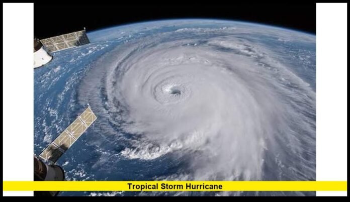

Tropical Storm Hurricane conditions remain an important weather concern as Hurricane Simon moves slowly along Mexico’s Pacific coast, bringing dangerous winds, flooding rainfall, and hazardous coastal conditions. The latest National Hurricane Center update for October 12, 2026, identifies Simon as a Category 3 hurricane with maximum sustained winds of 115 mph. Meanwhile, the National Hurricane Center reports no active tropical cyclones in the Atlantic basin at the time of its latest advisory.
The contrasting situations in the Pacific and Atlantic highlight why hurricane monitoring remains essential throughout October. Although the Atlantic has become comparatively quiet, Hurricane Simon presents a serious threat to parts of western Mexico. Heavy rainfall, flash flooding, mudslides, dangerous surf, and coastal inundation remain key concerns for communities near the storm.
For U.S. readers, monitoring the latest tropical weather information is important even when a storm remains offshore or approaches another country. Tropical systems can produce dangerous marine conditions and transport moisture over long distances. Forecast changes can also affect travel, coastal activities, and weather planning.
Latest Tropical Storm Hurricane Update
The National Hurricane Center continues to issue advisories for Hurricane Simon in the eastern North Pacific. Its latest reported position on October 12 places the storm near 20.1 degrees north latitude and 106.4 degrees west longitude.
The hurricane is moving northwest at approximately 2 mph. This slow movement is particularly concerning because a tropical cyclone that lingers near the coast can deliver prolonged periods of heavy rain and dangerous weather.
Here are the key details from the latest available National Hurricane Center information:
- Storm name: Hurricane Simon
- Current classification: Category 3 hurricane
- Maximum sustained winds: 115 mph
- Reported movement: Northwest at approximately 2 mph
- Reported location: Near 20.1°N, 106.4°W
- Minimum central pressure: 958 millibars
- Primary threat area: Mexico’s Pacific coast
- Main hazards: Dangerous winds, flooding rainfall, coastal hazards, and potentially life-threatening mudslides
These figures describe the storm at the time of the cited advisory. Hurricane intensity, location, and movement can change, so readers should consult the latest official advisory before making weather-related decisions.
The National Hurricane Center is the primary U.S. government authority for tracking tropical cyclones in the Atlantic and eastern Pacific. Its official website provides storm positions, forecast tracks, wind probabilities, rainfall outlooks, and active warnings.
Hurricane Simon: What Is Happening Now?
Hurricane Simon has become the central focus of current tropical weather monitoring in the eastern Pacific. The storm previously intensified into a major hurricane and has since weakened to Category 3 intensity.
However, weakening does not mean the danger has passed. A Category 3 hurricane remains capable of producing destructive winds and severe coastal impacts.
Simon has been moving slowly northwestward offshore of Mexico. That slow progress gives forecasters a difficult situation to evaluate because small changes in its direction or forward speed can influence which communities experience the worst conditions.
The storm has already contributed to flooding along Mexico’s Pacific coast. Emergency officials have been responding to hazardous conditions in affected communities, while authorities have urged residents and visitors to take warnings seriously.
Forecast concerns include intense rainfall, dangerous waves, coastal flooding, and mudslides in areas with steep terrain. Mountainous regions can face especially serious consequences when prolonged rainfall saturates hillsides and destabilizes soil.
Hurricane Simon’s precise future track remains important. Residents should not assume that a location is safe simply because the storm’s center remains offshore. Outer rainbands and coastal effects can extend far from the center of a hurricane.
Which Areas Face the Greatest Risk From Hurricane Simon?
Western Mexico remains the primary area of concern in the latest reports. Coastal communities and nearby inland regions can experience different hazards depending on their distance from the storm, local terrain, rainfall totals, and exposure to the ocean.
Jalisco
Jalisco is among the states facing significant weather concerns from Simon. The state includes coastal communities, mountainous terrain, and important tourist destinations.
Heavy rainfall can overwhelm drainage systems, flood roads, and trigger landslides. Coastal areas may also experience dangerous waves and strong currents.
Residents and visitors should follow local civil protection instructions, particularly in low-lying neighborhoods and areas close to rivers or unstable slopes.
Colima
Colima is another state exposed to dangerous rainfall and coastal conditions associated with Simon.
Intense rain can create flash flooding, especially in locations where water collects quickly or rivers respond rapidly to runoff. Mudslides can also threaten communities near hillsides and mountain roads.
Travelers should avoid flooded roadways and pay attention to official closures. Even relatively shallow moving water can create dangerous driving conditions.
Michoacán
Michoacán also faces a risk of heavy rain and flooding. The combination of coastal exposure and mountainous terrain makes local conditions particularly important.
Rainfall can cause damage beyond the immediate coastline, especially where water drains from higher elevations into populated areas. Residents should take evacuation notices seriously and avoid attempting to cross swollen streams.
Nayarit and Nearby Coastal Areas
Forecast changes can also affect other parts of western Mexico. Coastal residents should monitor local alerts rather than relying exclusively on the storm’s projected centerline.
The effects of a hurricane do not stop at state boundaries. Rainbands, surf, and changes in coastal water levels can affect a broad region.
Why Hurricane Simon’s Slow Movement Matters
A hurricane’s forward speed is an important part of its threat. Wind intensity matters, but the time a storm spends over or near a particular area can also influence the amount of rainfall and the duration of hazardous conditions.
Simon’s reported movement of approximately 2 mph means it is progressing slowly. When a tropical cyclone moves slowly, rainbands can repeatedly affect the same communities.
This can increase the risk of:
- Flash flooding in urban and rural areas.
- Rivers and streams rising rapidly.
- Mudslides and landslides on steep slopes.
- Road closures and interruptions to transportation.
- Damage to buildings and other infrastructure.
- Extended disruption to coastal tourism and local businesses.
A slow-moving storm does not automatically produce the same rainfall totals everywhere. Local topography, atmospheric conditions, and changes in the storm’s track all influence the final outcome.
Nevertheless, slow movement is a reason to remain cautious. Residents should continue following official warnings until local authorities confirm that conditions have improved.
Atlantic Hurricane Season Update: No Active Tropical Cyclones Reported
The latest National Hurricane Center tropical weather discussion for the Atlantic basin reports no active tropical cyclones as of October 12, 2026.
The Atlantic basin includes the Atlantic Ocean, Caribbean Sea, and Gulf of America. This update indicates that no tropical cyclone was active in that basin at the time of the advisory.
However, the absence of an active storm does not mean the Atlantic hurricane season has ended. October remains within the official Atlantic hurricane season, which runs from June 1 through November 30.
Tropical systems can develop late in the season when atmospheric and oceanic conditions become favorable. Forecasters therefore continue monitoring tropical waves, areas of disturbed weather, and other features that could organize into tropical depressions or stronger systems.
The Atlantic’s current status also illustrates why readers should distinguish between a quiet period and the end of the season. Conditions can change, and new advisories may become necessary if a disturbance develops.
For people living along the U.S. Gulf Coast, Florida, the southeastern states, and the Atlantic coastline, checking current forecasts remains a sensible precaution.
Tropical Storm vs. Hurricane: What Is the Difference?
The phrase Tropical Storm Hurricane often appears in online searches because people want to understand the difference between these storm classifications and determine how dangerous a developing system might be.
Tropical storms and hurricanes are both tropical cyclones. They form over warm tropical or subtropical waters and can produce heavy rain, strong winds, and coastal hazards.
The main distinction is sustained wind speed.
| Classification | Maximum sustained wind speed |
|---|---|
| Tropical depression | 38 mph or less |
| Tropical storm | 39–73 mph |
| Category 1 hurricane | 74–95 mph |
| Category 2 hurricane | 96–110 mph |
| Category 3 hurricane | 111–129 mph |
| Category 4 hurricane | 130–156 mph |
| Category 5 hurricane | 157 mph or higher |
These thresholds use the U.S. hurricane classification system based on maximum sustained winds.
A tropical depression can strengthen into a tropical storm as its sustained winds increase. If those winds reach 74 mph, the system qualifies as a hurricane in the Atlantic and eastern North Pacific.
Hurricanes are then assigned categories using the Saffir-Simpson Hurricane Wind Scale. The scale measures wind intensity, not every possible danger from a storm.
For example, a tropical storm can still produce deadly flooding. Likewise, a hurricane’s rainfall, storm surge, and waves may create severe impacts beyond what its category alone suggests.
Hurricane Simon’s reported sustained winds of 115 mph place it in Category 3. That classification identifies it as a major hurricane, but it does not fully describe the potential flooding and coastal dangers.
How Hurricanes Develop and Strengthen
Tropical cyclones generally require warm ocean water, abundant moisture, atmospheric instability, and suitable wind conditions to develop.
Warm water supplies energy to a developing system. As moist air rises and condenses, it releases heat that helps sustain the storm’s circulation.
A developing disturbance may first become a tropical depression. If its organization improves and its sustained winds increase, it can become a tropical storm and receive a name.
Further strengthening can produce hurricane conditions. However, not every tropical storm becomes a hurricane, and not every hurricane continues intensifying.
Several factors can limit a storm’s growth. Strong vertical wind shear can disrupt its circulation, while cooler ocean water can reduce the energy available to the system. Dry air and interaction with land can also weaken a tropical cyclone.
Storm movement matters, too. A hurricane that crosses mountainous terrain may weaken rapidly, while a system over favorable ocean conditions can maintain or increase its intensity.
These factors help explain why forecasters regularly update their projections. A forecast represents the expected evolution of a storm based on the available observations and scientific models, not a guarantee that conditions will remain unchanged.
Could Hurricane Simon Affect the United States?
Hurricane Simon’s primary threat remains focused on Mexico’s Pacific coast. Its position and forecast must be considered before drawing conclusions about direct impacts in the United States.
A hurricane does not automatically threaten the U.S. mainland simply because it exists in the eastern Pacific. Its track, intensity, interaction with land, and movement of moisture determine whether it may influence U.S. weather.
Tropical moisture can sometimes travel inland after a storm weakens or interacts with other weather systems. Such moisture may contribute to heavy rain in parts of the Southwest or other regions, depending on the broader atmospheric pattern.
However, possible indirect effects are different from a confirmed direct hurricane threat. Readers should not interpret the existence of Hurricane Simon as evidence that a U.S. landfall will occur.
The National Hurricane Center and the National Weather Service provide the most relevant official information for assessing potential U.S. impacts.
People in the Southwest and other areas mentioned in changing forecasts should monitor local weather alerts. The appropriate response depends on the forecast for their specific location rather than the storm’s name alone.
How to Prepare for Tropical Storm and Hurricane Conditions
Preparation remains important even when a storm is not approaching your immediate area. Hurricanes can create several hazards at once, including strong winds, flooding, power outages, and dangerous coastal conditions.
The following steps can help households prepare for tropical weather.
1. Monitor official alerts. Check updates from the National Hurricane Center, National Weather Service, and local emergency management agencies. Use current warnings rather than relying on older forecasts shared on social media.
2. Prepare emergency supplies. Keep drinking water, nonperishable food, flashlights, batteries, essential medications, and basic first-aid supplies available.
3. Charge electronic devices. Keep phones and backup batteries charged before severe weather arrives. Power outages can disrupt access to information.
4. Protect important documents. Store identification, insurance information, and essential records in a secure, water-resistant location.
5. Understand evacuation routes. Learn which routes local authorities recommend and identify suitable shelter options before an emergency develops.
6. Avoid floodwater. Never drive or walk through flooded roads when the depth or current is uncertain. Floodwater may conceal damaged pavement, debris, or dangerous currents.
7. Respect coastal warnings. Stay away from dangerous surf, rip currents, and storm-affected beaches. Waves can remain hazardous even when conditions appear calmer between sets.
8. Follow local instructions. If authorities order an evacuation, leave as directed. Do not wait for conditions to deteriorate before taking action.
These precautions apply to tropical storms as well as hurricanes. A storm’s classification provides useful information, but local hazards determine the safest response.
Where to Find the Latest Tropical Storm Hurricane Information
Reliable information becomes especially important when a storm changes direction or intensity. Forecast graphics and social media posts may circulate long after conditions have changed.
For the most accurate updates, use the following official resources:
- National Hurricane Center: Provides tropical cyclone advisories, forecast tracks, storm discussions, wind probabilities, and tropical weather outlooks.
- National Weather Service: Issues local forecasts, flood alerts, severe weather warnings, and other weather information for U.S. communities.
- Local emergency management agencies: Share evacuation instructions, shelter information, road closures, and community-specific safety guidance.
- NOAA weather resources: Offer information about tropical cyclones, coastal conditions, and other weather hazards.
When reviewing an update, check the advisory time, storm location, maximum sustained winds, forecast direction, and active warnings.
Pay attention to the distinction between observed conditions and future projections. A reported storm position describes where the system was located at the stated observation time, while a forecast estimates where it may travel.
This distinction matters because tropical cyclones can change quickly. A reliable weather decision should use the latest information available for the relevant location.
What the Current Hurricane Situation Means for October
October can remain an active period for tropical weather even when one ocean basin is quiet. The latest situation demonstrates this contrast: the Atlantic basin has no active tropical cyclones in the National Hurricane Center’s current report, while Hurricane Simon remains a significant concern in the eastern Pacific.
The two regions require separate forecasts because they have different weather patterns and storm systems. A quiet Atlantic does not indicate that the Pacific faces little danger, nor does a powerful Pacific hurricane mean the Atlantic must develop another storm.
For residents and travelers, the practical lesson is to focus on verified local threats. Hurricane categories, projected paths, rainfall estimates, and official warnings all provide useful information, but no single measurement captures every hazard.
Hurricane Simon’s slow movement and dangerous rainfall make continued monitoring important for affected Mexican communities. For U.S. readers, the key question is whether current official forecasts identify a specific risk to their region.
The most useful approach is to stay informed, avoid speculation about possible landfalls, and follow instructions from the authorities responsible for local safety.
Stay alert for the latest tropical storm and hurricane developments, follow official weather advisories, and share your questions or observations in the comments.
Common Questions and Answers
What is the latest Tropical Storm Hurricane update?
As of the latest National Hurricane Center information available for October 12, 2026, Hurricane Simon is a Category 3 hurricane in the eastern North Pacific, with maximum sustained winds of 115 mph. The Atlantic basin has no active tropical cyclones reported in the latest discussion.
Is Hurricane Simon a tropical storm or a hurricane?
Simon is classified as a hurricane, not a tropical storm. Its reported sustained winds of 115 mph place it in Category 3 on the Saffir-Simpson Hurricane Wind Scale.
Where is Hurricane Simon located?
The latest cited advisory places Simon near 20.1°N, 106.4°W, offshore of Mexico’s Pacific coast. Its reported movement is northwest at approximately 2 mph.
Which areas are threatened by Hurricane Simon?
Parts of western Mexico, including Jalisco, Colima, and Michoacán, face concerns about dangerous rainfall and coastal conditions. Local authorities determine specific warnings and evacuation requirements.
Is there an active hurricane in the Atlantic Ocean?
The National Hurricane Center’s latest Atlantic discussion for October 12, 2026, reports no active tropical cyclones in the Atlantic basin. This status can change if a new system develops.
Can a tropical storm become a hurricane?
Yes. A tropical storm becomes a hurricane when its maximum sustained winds reach at least 74 mph under the U.S. classification system.
What is the difference between a tropical storm and a hurricane?
A tropical storm has maximum sustained winds of 39–73 mph. A hurricane has sustained winds of at least 74 mph. Both can produce dangerous rainfall, flooding, and coastal hazards.
Does a Category 3 hurricane always cause more flooding than a tropical storm?
No. Hurricane categories measure wind speed rather than rainfall or flooding potential. A tropical storm can produce severe flooding under the right conditions, while a major hurricane can create multiple hazards simultaneously.
Could Hurricane Simon make landfall in the United States?
The current information cited here does not establish a U.S. landfall by Simon. Its primary threat is along Mexico’s Pacific coast. Readers should use updated official forecasts to assess any potential U.S. impacts.
Where can I check the latest hurricane warnings?
The National Hurricane Center provides tropical cyclone advisories and forecast information. The National Weather Service and local emergency management agencies provide warnings and safety instructions for specific U.S. communities.