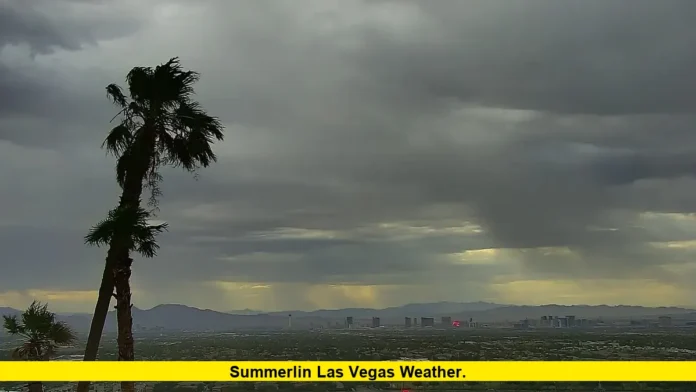

Summerlin Las Vegas weather is cooler today, with temperatures around 79–80°F and a brief chance of showers as Southern Nevada moves through an unsettled weather pattern. The latest forecast shows a noticeable break from the extreme heat experienced earlier this month, followed by a steady return toward warmer conditions.
Summerlin sits on the western side of the Las Vegas Valley, where elevation can produce different temperatures from locations closer to the valley floor. That difference can become especially noticeable during periods of extreme heat, strong winds or changing weather systems.
The latest outlook points to cooler conditions on Tuesday, September 29, followed by a substantial warmup during the first days of October. Residents and visitors can therefore expect a significant temperature change over a relatively short period.
Current Weather in Summerlin
The latest Summerlin South forecast places Tuesday’s daytime high around 79°F, with an overnight low near 63°F. Skies are expected to feature a mix of clouds and sunshine, while winds can become noticeable during the day.
The forecast also includes a small chance of precipitation. That represents a significant departure from the dry, hot conditions that have dominated much of the summer.
Weather conditions can vary across Summerlin because the community covers a broad area and sits at higher elevations than parts of central and eastern Las Vegas. As a result, temperatures reported for the wider Las Vegas Valley may not perfectly match conditions in Summerlin.
For September 29, the most relevant weather details are:
- Daytime high: Around 79–80°F
- Overnight low: Around 63–68°F
- Sky conditions: Partly cloudy to a mix of clouds and sunshine
- Rain chance: Low, with isolated shower or thunderstorm potential
- Wind: Moderate and occasionally gusty
- Overall pattern: Cooler than the recent heat, followed by warming
The current conditions are much closer to early-fall weather than the triple-digit temperatures that affected the region during several earlier periods in 2026.
Summerlin Forecast for the Next Several Days
The short-term forecast shows a clear warming trend after Tuesday.
Wednesday, September 30, is expected to bring a high close to 90°F. Thursday should remain warm, with temperatures rising into the low 90s. Friday through Sunday are expected to stay in the lower to middle 90s.
A simplified outlook shows the developing trend:
| Date | Expected High | Expected Low | General Pattern |
|---|---|---|---|
| September 29 | Around 79–80°F | Around 63–68°F | Cooler, partly cloudy |
| September 30 | Around 90°F | Around 69°F | Warmer and drier |
| October 1 | Around 92°F | Around 70°F | Mostly sunny |
| October 2 | Around 93°F | Around 71°F | Sunny and warmer |
| October 3 | Around 94°F | Around 72°F | Mostly sunny |
Forecast values can change as weather systems evolve, particularly during periods involving tropical moisture or thunderstorms. The broad trend, however, is clear: Summerlin is moving from a cooler weather window back toward typical early-October warmth.
Why Summerlin Can Be Cooler Than Other Parts of Las Vegas
Summerlin’s elevation is one of the most important factors affecting its weather.
The community is located at roughly 3,500 feet above sea level in many areas, with some portions reaching considerably higher elevations. The National Weather Service has noted that temperature generally decreases as elevation increases.
That helps explain why Summerlin can feel cooler than lower-elevation portions of the Las Vegas Valley.
The difference becomes more noticeable during major heat events. A temperature reading from a location closer to the valley floor may be several degrees warmer than a reading from Summerlin.
The effect is not limited to summer. Higher elevation can influence overnight temperatures, wind patterns, precipitation and occasional winter snowfall.
Summerlin’s western location also places it closer to the Spring Mountains. Those mountains influence the broader climate of the western Las Vegas Valley and contribute to differences in weather across the region.
September Weather Has Been Changing Quickly
September 2026 has featured several sharp swings in Southern Nevada temperatures.
The month followed an exceptionally hot August in Las Vegas. Local weather reports noted that August 2026 became the warmest August on record at the Las Vegas climate station, with an average temperature of 96.3°F.
September then brought additional heat before a cooling trend developed.
Las Vegas experienced another period of extreme heat in early September. Temperatures at Harry Reid International Airport reached 107°F on September 10, just one degree below the daily record for that date.
By mid-September, temperatures began easing. Local forecasts increasingly pointed toward a transition away from persistent triple-digit heat.
That transition is now becoming more apparent in Summerlin. The current forecast is considerably cooler than the conditions seen earlier in the month.
Rain and Thunderstorm Chances Around Summerlin
Although Summerlin normally receives very little rain, September can bring occasional thunderstorms when moisture moves into Southern Nevada.
That pattern has already appeared several times this month.
Scattered storms affected parts of the northern and western Las Vegas Valley, including Summerlin, on September 21. Thunderstorms produced lightning, thunder and gusty conditions in parts of the region.
The National Weather Service also identified increased precipitation chances for Monday and Tuesday as tropical moisture moved northward and a trough approached Southern Nevada.
The latest weather discussion highlighted the possibility of showers and thunderstorms, cooler temperatures and stronger storms in some parts of the broader region.
For Summerlin, the main point is that a low rain probability does not mean rain is impossible. Desert thunderstorms can be highly localized. One neighborhood may receive measurable rain while another nearby location remains dry.
Storms can also produce sudden wind gusts and brief periods of heavy rainfall.
Flash-Flood Risk During Desert Storms
Rainfall is relatively uncommon in Summerlin, but intense desert thunderstorms can create significant runoff.
The National Weather Service has emphasized that stronger storms in Southern Nevada and nearby areas can produce heavy rainfall, gusty winds, lightning and localized flash flooding.
Summerlin’s terrain and proximity to higher elevations make awareness of sudden weather changes important during active storm periods.
A storm does not need to last for hours to produce problems. Heavy rainfall over a short period can overwhelm normally dry washes, drainage channels and low-lying areas.
The greatest flash-flood concerns in the current regional forecast have been focused on other portions of Southern Nevada, including the Colorado River Valley and northwestern Arizona. Still, changing storm activity can affect different parts of the Las Vegas Valley.
Residents should therefore monitor official weather alerts whenever thunderstorms develop.
How Summerlin Weather Changes Through Fall
The transition from September into October typically brings a noticeable reduction in daytime temperatures.
Recent Summerlin South historical data places September’s average high around 87°F and average low around 62°F. October is substantially cooler, with a historical average high around 75°F and average low around 50°F.
Those figures represent long-term averages rather than a prediction for a particular year.
Daily temperatures can still vary widely. Summerlin may experience afternoons in the 90s during early October, followed by much cooler conditions later in the month.
The current forecast illustrates that variability. Temperatures are expected to move from around 80°F on September 29 toward the low and middle 90s during the following several days.
That pattern is typical of the desert Southwest, where seasonal changes can occur quickly but do not always produce a steady day-to-day decline.
Summerlin Weather and Wind Conditions
Wind is another important part of the local forecast.
The western Las Vegas Valley can experience noticeable winds when weather systems move through Southern Nevada. Gusts can become stronger around passing troughs, thunderstorms and major temperature changes.
The current weather pattern includes the potential for gusty conditions as the unsettled system moves through.
After the system exits, conditions are expected to become calmer and drier as temperatures rise.
Wind can also make temperatures feel different from the thermometer reading. A cool morning with a breeze may feel considerably more comfortable than a warm afternoon under direct sunlight.
For outdoor plans, the combination of temperature and wind is therefore more useful than temperature alone.
What the Latest Forecast Means for Summerlin
The immediate forecast represents a temporary break from the heat rather than the beginning of a prolonged cold spell.
Tuesday is expected to be the coolest day in the current forecast period, with temperatures around 80°F. By Wednesday, readings should return to the 90s.
The warming trend continues into the weekend, when highs are expected to reach the low to middle 90s.
This means Summerlin residents should be prepared for changing conditions over the next several days. Light layers may be useful during cooler mornings and evenings, while daytime conditions will again favor warm-weather clothing.
The precipitation threat is also expected to diminish as the weather system moves east and drier conditions return.
Summerlin Weather Compared With the Broader Las Vegas Valley
Weather conditions in Summerlin do not always mirror the official Las Vegas forecast.
Las Vegas forecasts often rely on observations and forecast points at lower elevations. Summerlin’s higher elevation and western location can produce cooler readings.
That difference matters most during extreme heat events.
The current situation provides another example. While broader Las Vegas forecasts have highlighted highs in the lower 80s during the cooler Tuesday period, Summerlin South forecasts are closer to the upper 70s.
Later in the week, however, temperatures across the valley are expected to rise together.
The practical takeaway is that people looking specifically for conditions in Summerlin should use a Summerlin or Summerlin South forecast rather than relying exclusively on a downtown Las Vegas reading.
The Bottom Line on Summerlin Weather
The latest forecast shows Summerlin moving through a short-lived cooler period on September 29 before temperatures climb again.
The immediate weather pattern includes clouds, a limited shower or thunderstorm chance and occasional wind. The more significant trend is the transition from Tuesday’s cooler conditions to highs around 90°F on Wednesday and into the 90s through the weekend.
The shift follows a month marked by major temperature swings, including periods of extreme heat and several rounds of unsettled weather.
Summerlin’s elevation continues to make its local weather somewhat different from lower parts of the Las Vegas Valley. That distinction is especially important when temperatures rise sharply or storms move across Southern Nevada.
For anyone checking conditions before heading outdoors, the latest local forecast remains the best guide because desert weather can change quickly from one day to the next.
Keep checking the latest Summerlin forecast as temperatures shift from September’s cooler spell toward October’s warmer desert weather.