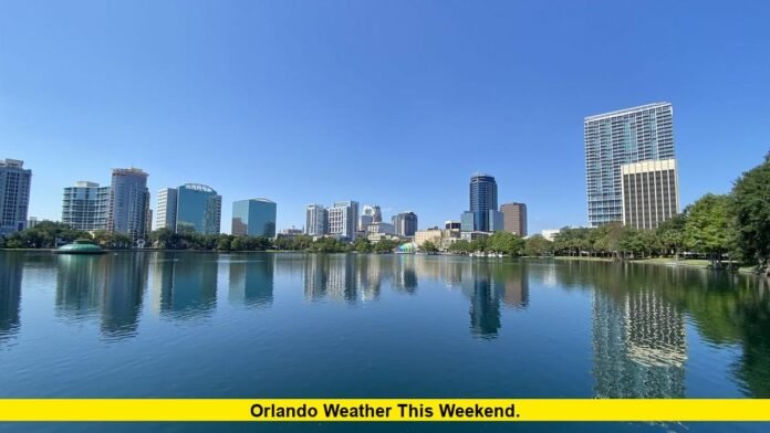

Orlando weather this weekend will remain hot, humid, and stormy, with rain and thunderstorms still expected across Central Florida on Saturday and Sunday. The latest forecast shows temperatures rising into the upper 80s and around 90 degrees, while rain chances remain elevated through the weekend.
The weather pattern follows several days of unusually wet conditions across the Orlando area. A stalled front and abundant tropical moisture have helped produce widespread showers and thunderstorms this week. Forecasters expect rainfall to become less persistent over the weekend, but storms will remain a significant part of the forecast.
For residents and visitors planning outdoor activities, Saturday and Sunday will not be complete washouts. However, conditions can change quickly, especially during the afternoon and evening when thunderstorms are most likely.
Orlando Weekend Weather at a Glance
The latest National Weather Service forecast for Orlando calls for warm temperatures and continued chances of showers and thunderstorms throughout the weekend.
| Day | Forecast High | Forecast Low | Rain/Storm Outlook |
|---|---|---|---|
| Friday, Oct. 9 | 86°F | 74°F | Showers and thunderstorms |
| Saturday, Oct. 10 | 88°F | 76°F | Chance of showers and thunderstorms |
| Sunday, Oct. 11 | 90°F | 75°F | Showers and thunderstorms likely |
The National Weather Service currently places Saturday’s chance of precipitation at about 85%, with a similar storm-focused setup continuing into Sunday. Sunday is expected to be warmer, reaching around 90 degrees, with a 65% precipitation chance in the latest forecast.
Other current forecast services show a similar overall pattern, although individual rainfall probabilities and temperature estimates vary slightly. The consistent message is that Orlando should remain warm, humid, and vulnerable to thunderstorms through the weekend.
Friday Sets the Tone for the Weekend
Friday, October 9, is expected to remain unsettled across Orlando. The National Weather Service forecasts showers and thunderstorms with a high near 86 degrees and a low around 74 degrees.
The atmosphere will continue to hold plenty of moisture, creating conditions favorable for periods of rain and thunderstorms. Forecast guidance indicates that rain will not necessarily continue without breaks. Instead, Orlando can expect changing conditions during the day, with periods of clouds, showers, and storms.
This matters for the weekend because the wet pattern is not expected to disappear immediately. Rain chances gradually ease compared with the wetter conditions earlier in the week, but they remain high enough to affect outdoor plans.
Saturday Weather Forecast for Orlando
Saturday, October 10, is shaping up to be a warm and stormy day. The latest National Weather Service forecast calls for a high near 88 degrees and a low around 76 degrees.
The official forecast currently lists an 85% chance of precipitation. Showers and thunderstorms remain possible throughout the day, making Saturday the wetter half of the weekend for many outdoor plans.
A separate Orlando forecast also points to afternoon thunderstorms, with temperatures reaching the upper 80s. Forecast differences are normal several days ahead, but the major trend remains consistent: Saturday will be hot, humid, and unsettled rather than cool or dry.
Local forecasters expect more breaks between storms than during the wetter part of the week. That means some outdoor activities may still be possible between showers, but anyone spending extended time outside should be prepared for a sudden downpour or thunderstorm.
Winds could also become breezy at times. The latest Central Florida forecast indicates that Saturday could see gusts around 20 to 25 mph as tropical moisture continues moving through the region.
Sunday Could Be the Warmest Day
Sunday, October 11, is expected to bring the highest temperature of the weekend. The National Weather Service currently forecasts a high around 90 degrees and a low near 75 degrees.
Rain chances remain significant, with showers and thunderstorms likely. The latest official forecast puts the chance of precipitation at about 65%.
That combination means Sunday could feel more like a typical warm Florida day than an early-fall weekend. Even if clouds temporarily reduce temperatures, humidity will continue contributing to a warmer feel.
Another current forecast places Sunday’s high around 90 degrees and gives the day a storm chance of roughly 55%. The exact percentage may change as the weekend approaches, but both forecasts indicate that thunderstorms remain possible.
Sunday may offer longer breaks between storms compared with earlier in the week. Local forecasters expect the overall rain pattern to gradually become less persistent, especially as the weekend progresses.
Will It Rain All Weekend in Orlando?
No. The current forecast does not indicate nonstop rain from Friday through Sunday.
Instead, Orlando is expected to experience a mixture of clouds, showers, thunderstorms, and breaks in the rain. The highest storm potential will generally favor periods when daytime heating and abundant moisture combine.
This distinction is important for anyone planning activities. A high rain probability does not mean rain will fall continuously across every part of Orlando for the entire day.
Thunderstorms can also be highly localized. One part of the Orlando area may experience heavy rain while another location remains relatively dry for a period of time. Conditions can then change rapidly as individual storms move across Central Florida.
The latest local forecast supports the expectation of elevated rain chances through Sunday while also indicating that longer dry periods should develop compared with the wetter conditions earlier this week.
How Warm Will Orlando Feel?
Temperatures will remain well above what many people associate with fall weather.
Friday should reach the mid-80s. Saturday is expected to climb to about 88 degrees, while Sunday could approach 90 degrees. Overnight temperatures will remain mild, generally in the mid-70s.
Humidity will add to the heat. Current forecasts describe the weekend as humid, with tropical moisture continuing to influence Central Florida.
For people spending several hours outdoors, the combination of high temperatures, humidity, and intermittent sunshine could make conditions feel warmer than the official thermometer readings suggest.
What Is Driving the Wet Weekend Pattern?
The current weather pattern is being influenced by a combination of tropical moisture and a stalled frontal boundary affecting Central Florida.
Local forecasters say Central Florida has another very wet period before rain chances gradually decrease over the weekend. A much drier and less humid air mass is expected to arrive next week after a weak front moves through the area.
The tropical environment has kept moisture levels high across the region. That moisture provides fuel for showers and thunderstorms, particularly during the warmer part of the day.
The result is a forecast that remains unsettled even as the most persistent rainfall begins to ease.
Is Hurricane Isaias Affecting Orlando’s Weekend Forecast?
Hurricane Isaias is an important part of the broader weather picture, but the latest local forecast indicates that the storm is expected to remain west of Central Florida.
As of Thursday, October 8, Isaias was strengthening over the Gulf of Mexico. The National Hurricane Center reported hurricane-force winds and continued intensification as the system moved east-northeastward.
The storm is forecast to approach the northern Gulf Coast and Florida Panhandle rather than make a direct approach toward Orlando. Local Central Florida forecasters expect Isaias to stay west of the Orlando area.
Even without a direct hit, a tropical system can influence weather patterns well away from its center. In this case, the broader tropical moisture flow is helping maintain elevated rain chances across Florida.
For Orlando this weekend, the primary concern remains showers, thunderstorms, humidity, and occasional breezy conditions rather than a direct hurricane impact.
Best Time for Outdoor Plans
The weekend forecast suggests that people should remain flexible with outdoor plans.
Saturday and Sunday both carry substantial rain chances. Afternoon and evening periods can be especially vulnerable to thunderstorms because daytime heating helps destabilize the atmosphere.
Morning hours may provide better opportunities for some outdoor activities, but showers cannot be ruled out. Current forecasts still show enough moisture across the region for rain at different times of the day.
A practical approach is to keep outdoor plans flexible and have an indoor alternative available. Checking the latest radar and forecast shortly before leaving is also important because individual thunderstorms can develop or move through Central Florida quickly.
What About Next Week?
The forecast becomes noticeably more favorable after the weekend.
A weak front is expected to move through Central Florida on Monday. Rain chances are forecast to fall significantly afterward, with local forecasters expecting a much drier and less humid pattern Tuesday and Wednesday.
The National Weather Service currently forecasts about a 30% precipitation chance Monday, followed by only a 5% chance Tuesday and 10% Wednesday. Temperatures should remain warm, with highs in the upper 80s.
That expected transition gives Orlando a clear weather change after the stormier weekend.
What Orlando Residents and Visitors Should Expect
The latest forecast points to several clear takeaways for the weekend:
- Friday remains wet and unsettled.
- Saturday should be warm, humid, and stormy, with a high near 88 degrees.
- Sunday could reach around 90 degrees.
- Thunderstorms remain possible both weekend days.
- Rain will come in periods rather than continuously.
- Breezy conditions may develop at times Saturday.
- Hurricane Isaias is expected to remain west of Central Florida.
- More comfortable and drier conditions are expected after the weekend.
The forecast will continue to evolve as atmospheric conditions change. Rainfall coverage and storm timing can shift considerably in Florida, especially when tropical moisture is involved.
For that reason, the most useful forecast for a specific outdoor event will be the latest hourly and radar information available on the day itself.
Orlando Weekend Weather Outlook
Overall, Orlando is heading into a warm but unsettled October weekend. Saturday and Sunday should feel more like summer than fall, with temperatures near 90 degrees, high humidity, and recurring opportunities for thunderstorms.
The good news is that the weekend is not expected to be a continuous washout. There should be breaks in the rain, particularly as the weekend progresses. Still, the elevated storm chances mean outdoor plans should include flexibility.
The bigger weather shift is expected early next week. A front should help push tropical moisture away from Central Florida, allowing rain chances and humidity to drop substantially.
If you’re planning to be in Orlando this weekend, keep checking the latest forecast because storm timing can change quickly across Central Florida.