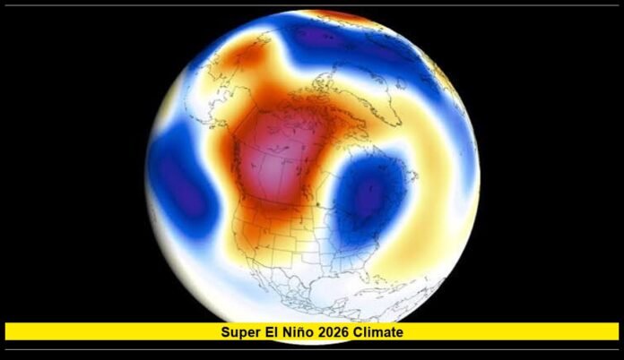

The super el niño 2026 climate outlook is drawing increasing attention as the tropical Pacific continues to warm and forecasts point toward an unusually powerful El Niño event during the second half of 2026 and into early 2027. The latest outlooks indicate that this could become one of the strongest El Niño events observed in the modern record, raising concerns about extreme heat, drought, flooding, agriculture, hurricanes and other weather disruptions around the world.
Key Points Summary
╔════════════════════════════════════════════════════════════════════╗
║ – El Niño is strengthening rapidly across the tropical Pacific and is expected to intensify through late 2026. ║
║ – NOAA’s August outlook gives a 95% chance of a very strong El Niño during October–December 2026. ║
║ – NOAA also estimates a 69% chance that the event could reach a historic level of at least +2.5°C on its relative Niño index. ║
║ – The term “super El Niño” is widely used in media coverage but is not an official NOAA classification. ║
║ – The strongest impacts could include unusual heat, drought, flooding, wildfire risk and agricultural disruptions across different regions. ║
╚════════════════════════════════════════════════════════════════════╝
What Is Happening With El Niño in 2026?
El Niño is a naturally occurring climate pattern involving warmer-than-average ocean temperatures across the central and eastern tropical Pacific. Those warmer waters interact with the atmosphere and can alter jet streams, rainfall patterns, storm tracks and temperatures far beyond the Pacific Ocean.
The 2026 event is developing particularly quickly. Earlier forecasts expected El Niño to emerge during the Northern Hemisphere summer, but the pattern has strengthened substantially as warmer water has spread across the equatorial Pacific.
By August, NOAA’s Climate Prediction Center had moved toward an exceptionally strong outlook. Its latest strength probabilities show a 95% chance of a very strong El Niño during October through December 2026. The probability remains elevated through the following winter, although the event is expected to gradually weaken later in 2027.
That does not mean every location will experience extreme weather. El Niño changes the odds of particular weather patterns rather than determining the weather in a specific city on a specific day.
Why Are Forecasters Talking About a “Super El Niño”?
The expression “super El Niño” has become common in news coverage because the projected strength is far beyond a typical El Niño. However, it is important to understand that “super El Niño” is not an official NOAA category.
NOAA generally classifies El Niño strength using temperature-based measurements in the tropical Pacific. Its highest published category is “very strong,” generally corresponding to a relative Niño index of at least +2.0°C.
The latest outlook goes even further. NOAA has estimated a 69% probability that the October–December 2026 event could reach or exceed +2.5°C, a threshold that would place it at a historic level compared with events in the record going back to 1950.
That is why descriptions such as “historic El Niño” and “super El Niño” are appearing more frequently.
The distinction matters because the terminology can sometimes make the forecast sound more certain than it actually is. A very strong El Niño is increasingly likely, but the precise peak strength and its regional consequences will continue to evolve.
When Could the 2026 El Niño Peak?
Current forecasts point to the period between fall 2026 and winter 2026–27 as the most important part of the event.
NOAA’s August strength probabilities put the likelihood of a very strong El Niño at:
- 75% for August–October
- 93% for September–November
- 95% for October–December
- 90% for November–January
- 70% for December–February
The strongest signal therefore centers on late fall and early winter.
Experimental modeling from NOAA’s Geophysical Fluid Dynamics Laboratory also indicates that the event could peak sometime between October 2026 and January 2027. Multiple model simulations show an unusually strong peak competing with some of the largest El Niño events in the historical record.
Forecast confidence is relatively high for the broad trend, although exact peak temperatures and regional weather outcomes remain uncertain.
How Could It Affect the United States?
El Niño can produce very different weather patterns across the United States depending on the season and location.
During winter, the southern tier of the country often has an increased probability of wetter conditions during El Niño years. Parts of the Southwest, southern Plains and Gulf Coast can see more frequent storm systems, although individual seasons can vary considerably.
The northern tier can experience a different pattern, with warmer conditions sometimes favored across parts of the northern United States. Changes in the jet stream can also influence snowfall, cold-air outbreaks and storm tracks.
For the Pacific Northwest, the effects are less straightforward than the simple idea that El Niño automatically means warmer or drier weather everywhere. Regional outcomes depend on the exact configuration of atmospheric circulation.
The important point is that a stronger El Niño generally makes some characteristic patterns more likely, but it does not guarantee them.
What About Heat and Global Temperatures?
One of the biggest concerns surrounding the developing event is its contribution to global temperatures.
El Niño releases additional heat from the tropical Pacific into the atmosphere and changes the distribution of heat around the planet. When an unusually strong El Niño occurs against a background of long-term global warming, the combined effect can produce exceptionally high global temperatures.
The 2023–24 El Niño contributed to record-breaking global warmth. Scientists are watching the 2026–27 event closely because another major El Niño could temporarily push global temperatures substantially higher.
However, El Niño itself does not explain the long-term warming trend. Human-caused greenhouse gas emissions remain the primary driver of the planet’s continuing long-term temperature increase.
The significance of the current event is that natural climate variability could temporarily add to an already warmer baseline.
Could the Amazon Face Severe Drought?
The Amazon is among the regions receiving particularly close attention.
Strong El Niño events can shift rainfall patterns across South America, increasing drought risk in parts of the Amazon basin. Lower rainfall can reduce river levels, create transportation difficulties and increase vegetation stress.
A severe dry period combined with unusually high temperatures can also raise wildfire risk. The concern is especially significant because parts of the Amazon have already experienced repeated climate and land-use pressures.
The timing of the projected 2026 peak is another reason for concern. If the strongest phase coincides with an already stressful dry season, the consequences could become more pronounced.
At the same time, rainfall responses are not uniform throughout South America. Some areas, especially farther south, can experience wetter conditions during El Niño.
Effects on Asia and Australia
El Niño traditionally brings a higher risk of below-average rainfall to parts of Southeast Asia and Australia.
Indonesia and nearby regions can face increased drought and wildfire risks when rainfall decreases. Agricultural production may also be affected if dry conditions persist during critical growing periods.
Australia can experience warmer and drier conditions in many El Niño years, although local outcomes depend on other climate drivers.
Parts of South Asia may also experience reduced rainfall, creating concerns for agriculture, water supplies and food prices.
Malaysia has already warned that a strong El Niño could contribute to exceptional heat and reduced rainfall into 2027. The country’s meteorological authorities have highlighted the potential for temperatures to challenge historical records.
Why Agriculture Is a Major Concern
Agriculture may be one of the largest economic sectors affected by an exceptionally strong El Niño.
Weather changes can influence crop yields, transportation, irrigation requirements and commodity prices simultaneously.
Coffee, cocoa, sugar, rice, wheat, corn and other major crops are particularly sensitive to shifts in rainfall and temperature.
West Africa’s cocoa-producing region can experience damaging combinations of excessive rainfall followed by heat and dryness. Southeast Asian coffee-producing areas may face heat and drought concerns, while South American agriculture can experience a mixture of favorable and unfavorable conditions depending on location.
The result is not necessarily a global food shortage, but stronger weather volatility can increase production risks and market uncertainty.
What Could Happen to the Atlantic Hurricane Season?
El Niño is often associated with increased upper-level winds over the tropical Atlantic. This wind shear can make it more difficult for tropical systems to organize and strengthen.
That is one reason the developing El Niño is already influencing expectations for the 2026 Atlantic hurricane season.
A strong El Niño generally suppresses Atlantic tropical cyclone activity compared with seasons dominated by neutral conditions or La Niña. However, it does not eliminate hurricanes.
The Atlantic remains influenced by sea-surface temperatures, atmospheric moisture, African easterly waves and other climate factors. A quieter overall season can still contain powerful hurricanes.
Meanwhile, El Niño can increase tropical cyclone activity in other parts of the Pacific, illustrating why its effects are global but highly regional.
Could the 2026 Event Break Historical Records?
That possibility is becoming increasingly serious.
The strongest El Niño events commonly discussed in modern climate history include 1982–83, 1997–98 and 2015–16. Each produced major changes in global weather, ecosystems and economies.
The latest 2026 forecasts suggest that the developing event could enter the same conversation.
NOAA’s latest outlook indicates a very high probability of a very strong event, while its historic-threshold estimate suggests a meaningful chance of reaching a level that would exceed previous events in the record beginning in 1950.
Still, breaking a historical record remains a forecast possibility rather than a confirmed outcome.
Ocean temperatures, winds and atmospheric circulation will continue changing over the coming months. Scientists will therefore continue updating the forecast as new observations become available.
What Should People Watch Through Fall 2026?
The most important indicators will be ocean temperatures in the Niño regions, trade-wind behavior, subsurface Pacific heat and the atmosphere’s response to the warming ocean.
Forecasters will also watch:
- Whether Pacific sea temperatures continue rising
- How quickly the warm water spreads eastward
- Whether atmospheric circulation remains strongly coupled with ocean conditions
- Changes in global rainfall patterns
- Drought development across vulnerable regions
- Tropical cyclone activity in the Atlantic and Pacific
- Agricultural weather across major producing regions
- River levels and wildfire conditions in drought-prone areas
These indicators will help determine whether the current forecast continues to strengthen or begins to moderate.
What Does the Latest Forecast Mean for 2027?
The influence of El Niño is expected to continue into early 2027.
NOAA’s current outlook gives very high odds that El Niño will remain in place through the Northern Hemisphere winter. However, the probability of the strongest categories decreases as the forecast moves farther into 2027.
That means the most intense phase is expected to occur around late 2026 or early winter 2027, followed by a gradual weakening.
The eventual transition after El Niño is still uncertain. ENSO can move toward neutral conditions, while some historical events have eventually been followed by La Niña.
Why This Forecast Matters
The significance of the developing event goes beyond temperature numbers in the Pacific Ocean.
A major El Niño can influence food production, energy demand, water availability, transportation, wildfire risk, ecosystems and weather-related economic losses across multiple continents.
For households, businesses and governments, the most useful approach is not to assume that every forecasted effect will occur. Instead, the event should be treated as a signal that certain weather risks have become more likely.
Communities vulnerable to drought may need to review water planning. Agricultural producers may need to prepare for changing rainfall and temperature patterns. Emergency managers can use seasonal forecasts to improve readiness for floods, heat, wildfire and other hazards.
Bottom Line
The super el niño 2026 climate outlook has moved from a developing possibility to one of the most closely watched climate patterns of the year. NOAA’s latest forecast strongly favors a very strong El Niño during the final months of 2026, with a significant possibility that the event could reach historic strength.
The term “super El Niño” should still be used carefully because it is not an official scientific classification. What is clear is that the tropical Pacific is undergoing a major warming event, and the probability of an exceptionally strong El Niño has risen sharply.
The coming months will determine how closely the event resembles the most powerful El Niños of the modern era. For now, scientists, farmers, governments, businesses and communities around the world are preparing for a climate pattern capable of reshaping weather risks across multiple continents.
What do you think about the developing El Niño outlook? Share your thoughts below and stay tuned for the latest climate updates as the Pacific event develops