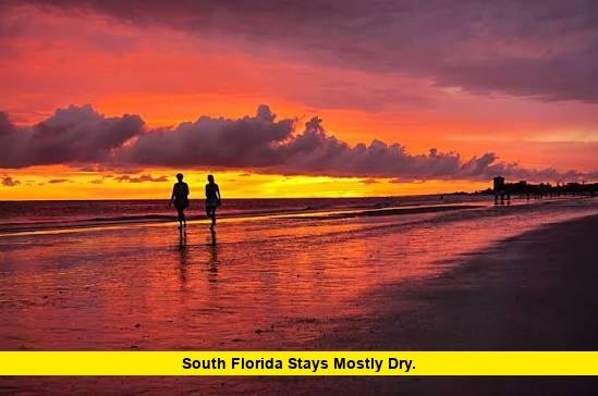

South Florida stays mostly dry on Friday, August 14, 2026, as a thick layer of Saharan dust settles over the region and keeps storm chances low. The tradeoff isn’t a pleasant one, though. With that dust comes a stretch of dangerously hot, humid air that forecasters say will linger straight through the weekend.
A Heat Advisory covers Miami-Dade and the surrounding area from 11 a.m. until 7 p.m. today, with heat index values climbing as high as 106 to 110 degrees in spots. Meteorologists in West Palm Beach echoed that warning, calling for peak heat index readings between 105 and 110 degrees across Palm Beach County as well. Anyone spending time outside this afternoon should plan accordingly.
Heat Advisory Stretches Across the Region
Friday marks yet another entry in what has become a nearly weekly pattern this August: a fresh Heat Advisory posted for South Florida. Thursday, August 13, brought its own advisory, with feels-like temperatures pushing into the triple digits across Miami-Dade and Broward counties.
Today’s advisory runs from late morning into the early evening, covering the hottest stretch of the afternoon when the sun sits highest and humidity peaks. Highs will land in the low 90s along the coast, with some inland communities flirting with the mid-90s. Add in Florida’s trademark humidity, and it will feel closer to 105 degrees or warmer for hours at a stretch.
Forecasters note that easterly winds around 5 to 10 mph will offer only marginal relief. The National Weather Service in Miami is urging residents to limit strenuous outdoor activity during peak advisory hours, stay hydrated, and check on elderly neighbors or anyone without reliable access to air conditioning.
Why South Florida Stays Mostly Dry This Week
The reason behind the dry stretch traces back to the Sahara Desert, thousands of miles away. A dense plume of Saharan dust, technically known as the Saharan Air Layer, has pushed into the region and settled over South and Central Florida. That layer of dry, dusty air sits in the middle levels of the atmosphere and acts like a lid on developing thunderstorms.
Florida’s typical summer storms need three ingredients: strong sunshine, high heat, and abundant moisture. The Saharan Air Layer strips away that moisture and introduces sinking, stable air that makes it much harder for clouds to build into anything more than isolated afternoon showers. That’s the core reason South Florida stays mostly dry heading into the weekend, even during what is normally the peak of the summer rainy season.
High pressure, both at the surface and higher in the atmosphere, is reinforcing that pattern. The combination of sinking air and light south-to-southeast winds is expected to hold through the weekend, keeping both the heat and the dry conditions locked in place.
Isolated Storms Still Possible, Mainly Inland
Dry doesn’t mean completely rain-free. A 30 percent chance of afternoon storms remains in play for Friday, with any activity concentrated mainly over Miami-Dade and Broward counties, particularly west of Interstate 95 during the mid- to late-afternoon hours. Southwest Florida communities have a slightly better shot at catching a stray shower or storm compared to the immediate coast.
Saturday brings a similar setup, with rain chances holding around 30 percent. From there, forecasters expect conditions to dry out even further. Rain probabilities are projected to drop to around 10 percent on both Sunday and Monday as the Saharan dust reasserts itself across the peninsula.
Coastal residents can expect mostly clear skies overnight into Friday morning, followed by a chance of showers and thunderstorms redeveloping after midnight in some spots, according to the latest zone forecast for the Miami metro area.
Tropical Atlantic Stays Quiet for Now
The same dry, dusty air that’s suppressing storms over Florida is also playing a role in the broader tropical Atlantic. Forecasters are tracking two tropical waves, designated AL92 and AL94, but neither poses an immediate threat to Florida. AL92’s formation odds have actually decreased in recent days, while AL94 sits at roughly a coin-flip chance of development.
Saharan dust tends to work against tropical development because it dries out the atmosphere and strengthens wind shear, both of which make it harder for disorganized storm clusters to spin up into anything more organized. That’s a welcome pattern for hurricane season, even if it comes paired with punishing heat on land.
A Good Weekend for the Water, a Tough One on Land
There’s a silver lining buried in this forecast. Boaters and beachgoers heading out on the water this weekend will find favorable conditions, with winds staying light at roughly 5 to 10 knots and seas running 2 feet or less. For anyone looking to escape the heat with a day on a boat or paddleboard, this weekend offers close to ideal conditions.
On land, it’s a different story. UV index levels remain in the extreme range through the afternoon hours, and hazy skies from the dust plume may reduce visibility slightly, particularly during sunrise and sunset. Sensitive groups, including people with respiratory conditions, may notice mild irritation from the dust as well.
How Long Will the Pattern Last
Meteorologists expect this dry, hot stretch to hold through the weekend and into early next week. Once the Saharan Air Layer begins to thin out, typically within several days to a week, moisture will gradually return to the region and afternoon thunderstorm chances should climb back toward the more typical late-summer pattern South Florida sees for the remainder of hurricane season.
Until then, residents can expect a repeat performance: sunny skies, oppressive humidity, minimal rain, and another round of heat advisories likely before the pattern finally breaks.
Staying Safe During the Advisory
- Limit outdoor exertion between 11 a.m. and 7 p.m., when the advisory is active
- Drink water consistently rather than waiting until feeling thirsty
- Wear light-colored, loose-fitting clothing if spending time outside
- Never leave children or pets unattended in a parked vehicle
- Check on elderly relatives, neighbors, or anyone without reliable air conditioning
- Watch for early signs of heat exhaustion, including dizziness, heavy sweating, and nausea
South Florida stays mostly dry through the weekend, but the trade-off is clear: less rain, more heat, and conditions that call for real caution outdoors. Residents planning weekend activities should build in shade breaks, hydration, and a close eye on the latest advisories from local forecasters.
What’s your plan for beating the heat this weekend? Drop a comment below and let us know how you’re staying cool.