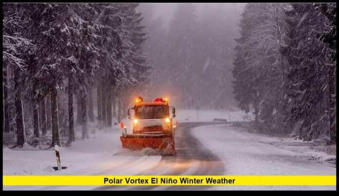

The polar vortex el niño winter weather outlook for 2026–2027 is drawing growing attention as an exceptionally strong Pacific Ocean warming event develops alongside unusual changes in the Arctic atmosphere. These competing weather influences could shape temperature patterns, precipitation, and winter storm activity across the United States over the coming months. While the broader seasonal outlook favors warmer conditions across much of the northern country, the possibility of sudden Arctic air outbreaks means Americans should not assume that extreme cold and heavy snowfall are off the table.
The developing El Niño is expected to influence the position of the jet stream, potentially creating a more active storm track across the southern United States and parts of the East Coast. Meanwhile, an unusually early disruption of the polar vortex has raised questions about whether colder Arctic air could eventually reach portions of North America.
Meteorologists are watching these developments closely because the upcoming winter could produce contrasting conditions across different regions. Some communities may experience extended mild periods, while others could face heavy rain, freezing temperatures, dangerous ice, and powerful winter storms.
Key Points Summary
╔════════════════════════════════════════════════════════════════════╗
║ – El Niño is strengthening and could remain strong to very strong through early 2027. ║
║ – The northern United States has an increased likelihood of warmer-than-average winter temperatures. ║
║ – Wetter-than-average conditions are favored across the southern states and much of the East Coast. ║
║ – An unusually early polar vortex disruption has introduced additional uncertainty into the winter forecast. ║
║ – Arctic air outbreaks remain possible despite the warmer seasonal temperature outlook. ║
║ – California, the Southwest, Gulf Coast and Southeast could experience periods of increased storm activity. ║
║ – Seasonal forecasts cannot determine exact snowfall totals or the timing of individual winter storms. ║
╚════════════════════════════════════════════════════════════════════╝
A Powerful El Niño Could Reshape the 2026–2027 Winter
El Niño is one of the most important climate influences heading into the winter season. It develops when ocean temperatures become warmer than normal across the central and eastern equatorial Pacific, affecting atmospheric circulation around the world.
The latest November climate assessment indicates that the current event continues to strengthen. A strong-to-very-strong El Niño is considered likely through the January–March 2027 period.
The warming across the tropical Pacific is particularly significant because it can influence the location of tropical rainfall, atmospheric pressure patterns, and large-scale wind circulation.
One of the most important consequences for the United States is the potential strengthening and southward displacement of the Pacific jet stream.
This can encourage more frequent storm development across the southern part of the country, increasing precipitation opportunities from California toward the Gulf Coast and East Coast.
However, the strength of El Niño does not guarantee identical conditions every year. Other climate influences, including the Arctic Oscillation, North Atlantic Oscillation, and shorter-term atmospheric disturbances, can change the expected outcome.
Unusually Early Polar Vortex Disruption Raises Winter Concerns
Another major development involves the polar vortex, a large circulation of strong winds surrounding the Arctic during the colder months.
The stratospheric polar vortex generally helps keep extremely cold Arctic air concentrated near the North Pole. When the circulation becomes weaker, stretched, or displaced, the broader atmospheric pattern can change.
Meteorological analysis in early November identified an exceptionally early disruption of the polar vortex, raising the possibility of changes to North American weather later in the season.
This development is unusual because major polar vortex disturbances are more commonly discussed during the heart of winter.
However, an early disruption does not automatically mean that the United States will experience widespread freezing conditions.
The effects of changes high in the atmosphere can take time to influence the jet stream and weather near the surface. In some situations, the resulting pattern may favor colder conditions across Europe or Asia rather than North America.
The location, duration, and strength of the atmospheric response will determine whether the United States experiences meaningful Arctic cold.
Could Arctic Air Reach the United States Before Winter Peaks?
The possibility of Arctic air moving south is one of the biggest questions surrounding the upcoming season.
When the polar vortex weakens, atmospheric circulation can become more favorable for cold air to move away from the Arctic. Depending on the configuration of pressure systems, these changes can influence temperatures across Canada and the United States.
Some of the areas that meteorologists will monitor include:
- Northern Plains: Cold-air intrusions could bring sharp temperature declines and dangerous wind chills.
- Upper Midwest: Minnesota, Wisconsin, and Michigan could experience sudden changes from mild conditions to freezing weather.
- Great Lakes: Cold air interacting with moisture could create opportunities for lake-effect snow.
- Northeast: Atmospheric blocking patterns could increase the potential for sustained cold spells and coastal winter storms.
- Central Plains: Temperature contrasts could support powerful storm development when Arctic air meets warmer, moisture-rich air.
- Southern States: Strong cold outbreaks could occasionally bring freezing temperatures into areas that are less accustomed to prolonged winter conditions.
These are potential weather scenarios rather than confirmed regional predictions.
The most important factor will be whether atmospheric changes associated with the Arctic circulation move downward and influence the weather patterns that control temperatures near the ground.
NOAA’s Winter Outlook Shows Warmer Conditions Across Much of the North
The official December 2026 through February 2027 winter outlook points toward a relatively warm seasonal pattern across much of the northern United States.
The strongest probabilities for above-average temperatures cover areas including the Pacific Northwest, northern California, northern Rockies, Midwest, Mississippi Valley, much of the East, and Alaska.
Parts of the Southeast, particularly Florida, have a greater likelihood of near-normal seasonal temperatures.
The Southwest and Hawaii have less clearly defined temperature signals, meaning that below-average, near-average, and above-average outcomes remain possible in those areas.
This outlook reflects the expected influence of the developing El Niño.
However, seasonal temperature averages should not be confused with daily weather conditions.
A state can experience several weeks of unusually mild weather and still experience a significant cold outbreak during January or February.
For residents, this distinction matters because even a short period of extreme cold can create dangerous conditions for roads, homes, businesses, and electrical infrastructure.
Southern States Could Experience More Rain and Active Storm Systems
Precipitation is another important part of the winter forecast.
Wetter-than-average conditions are favored across a broad region stretching from the Southwest through the southern United States and toward the East Coast.
This pattern could be particularly important for California, Arizona, New Mexico, Texas, Louisiana, Mississippi, Alabama, Georgia, and Florida.
An active southern storm track could bring repeated periods of rainfall to these locations.
For drought-affected communities, additional precipitation could provide meaningful relief. However, excessive rainfall can also create serious problems.
Heavy rain falling over a short period can overwhelm drainage systems, cause flash flooding, and increase the risk of landslides.
California deserves particular attention because atmospheric river events can deliver large quantities of Pacific moisture in a relatively short period.
The combination of heavy rainfall, saturated ground, and steep terrain can create dangerous conditions in vulnerable communities.
The Southeast could also experience periods of unsettled weather, with rainfall amounts varying considerably between individual storm systems.
Will the Northeast Experience Heavy Snowstorms This Winter?
The Northeast is entering winter with a complicated outlook.
Seasonal temperature probabilities generally favor warmer-than-average conditions across much of the region. At the same time, increased precipitation is favored along the East Coast.
This combination does not eliminate the possibility of major snowstorms.
Winter storms depend on the relationship between moisture, temperature, atmospheric pressure, and the movement of cold air.
A coastal storm could bring heavy snowfall to inland areas while producing rain closer to the Atlantic coastline.
If Arctic air is already established across the Northeast, a developing storm could produce substantial snowfall and strong winds.
Cities such as Boston, New York, Philadelphia, and surrounding communities will need to monitor individual storm forecasts as winter progresses.
The timing of cold-air outbreaks will be especially important. A storm arriving during a warmer period may produce rain, while a similar system developing under colder conditions could deliver significant snowfall.
California and the Southwest Face Important Winter Weather Changes
California and the broader Southwest could experience an active precipitation pattern during the upcoming winter.
The influence of El Niño often favors a more active southern storm track, which can direct Pacific moisture toward the region.
California could experience multiple rounds of heavy rain, particularly during periods when atmospheric rivers develop.
Mountain communities could also receive substantial snowfall, depending on elevation and temperatures during individual storms.
Arizona and New Mexico may see increased precipitation opportunities, although the exact distribution will vary across the region.
For drought-affected areas, the additional moisture could improve soil conditions, replenish reservoirs, and support water resources.
Nevertheless, communities should remain alert to flood risks.
Heavy precipitation does not always provide immediate drought relief because intense rainfall can run off quickly rather than soaking into the ground.
How the Jet Stream Could Influence Winter Storm Development
The jet stream is a powerful current of fast-moving air high above the Earth’s surface.
It influences the direction in which weather systems travel and helps determine where warm and cold air masses interact.
During strong El Niño events, the Pacific jet stream can become more active and extend farther eastward.
This may support a more organized storm track across the southern United States.
At the same time, changes in Arctic circulation can influence the position and shape of the jet stream, sometimes creating larger north-south movements.
These atmospheric interactions can produce significant temperature differences over relatively short distances.
For example, one region may experience unusually mild temperatures while another experiences a major cold outbreak.
The interaction between tropical Pacific warming and Arctic atmospheric changes will therefore be important throughout the winter.
The Arctic Oscillation and North Atlantic Oscillation Also Matter
El Niño and the polar vortex are not the only factors influencing winter weather.
Two additional atmospheric patterns could play an important role during the 2026–2027 season.
Arctic Oscillation (AO)
The Arctic Oscillation describes changes in atmospheric pressure between the Arctic and surrounding middle latitudes.
A positive AO generally favors stronger circulation around the Arctic, which can help limit the movement of the coldest air toward lower latitudes.
A negative AO can create conditions that are more favorable for Arctic air to move south.
North Atlantic Oscillation (NAO)
The North Atlantic Oscillation measures pressure differences across the North Atlantic.
Its phases can influence storm tracks and temperature patterns across eastern North America.
A negative NAO can sometimes encourage blocking patterns that support colder conditions across parts of the eastern United States.
When these patterns interact with El Niño and the polar vortex, the resulting winter forecast can become more complicated.
Can a Strong El Niño Still Produce Dangerous Winter Weather?
Yes. A powerful El Niño does not mean the United States will avoid dangerous winter conditions.
Even when seasonal temperatures are expected to remain above average, individual weather systems can produce heavy snow, freezing rain, sleet, and extreme cold.
Ice storms are particularly concerning because freezing rain can coat roads, trees, and electrical infrastructure with dangerous layers of ice.
Blizzards can also develop when strong winds combine with heavy snowfall and reduced visibility.
The central and eastern United States remain important areas to watch for changing winter conditions.
Residents should not rely exclusively on seasonal temperature averages when preparing for severe weather.
Local forecasts, storm warnings, and short-range weather predictions provide more useful information about immediate risks.
What Americans Should Prepare for During Winter 2026–2027
Changing winter conditions can affect everyday activities, transportation, household budgets, and public safety.
Even communities expecting warmer seasonal temperatures should prepare for occasional periods of extreme weather.
Important precautions include:
- Check heating equipment: Make sure furnaces and heating systems are operating properly before freezing temperatures arrive.
- Protect water pipes: Insulate exposed plumbing to reduce the risk of freezing and bursting.
- Prepare emergency supplies: Keep drinking water, food, flashlights, batteries, and necessary medications available.
- Monitor road conditions: Avoid unnecessary travel during freezing rain, heavy snowfall, and blizzard conditions.
- Watch flood alerts: Communities experiencing heavy winter rainfall should pay attention to drainage and flash-flood warnings.
- Prepare vehicles: Check tires, windshield wipers, batteries, and emergency equipment before severe weather develops.
- Follow local forecasts: Pay attention to changing watches, warnings, and advisories throughout the winter.
Preparation is especially important for households in regions where temperatures can change rapidly.
What to Expect as the 2026–2027 Winter Progresses
The coming months will reveal how the different atmospheric patterns influence one another.
Meteorologists will continue monitoring Pacific Ocean temperatures, Arctic circulation, stratospheric conditions, and changes in the jet stream.
The early polar vortex disruption has introduced an additional source of uncertainty, but the strong El Niño remains a major influence on the broader seasonal outlook.
The biggest developments to watch include whether the Arctic circulation experiences further weakening, whether cold air becomes more persistent across North America, and how frequently storm systems develop along the southern and eastern United States.
Forecast confidence will improve as individual weather systems move closer to the country.
For now, Americans should expect regional differences rather than one uniform winter pattern.
Frequently Asked Questions
1. Will winter 2026–2027 be colder than normal in the United States?
Not across most of the country. The seasonal outlook favors above-average temperatures across much of the northern United States and parts of the East. However, temporary periods of extreme cold remain possible.
2. Is El Niño expected to remain strong through January 2027?
Current climate projections favor a strong-to-very-strong El Niño through January–March 2027. Its influence could remain important throughout the winter.
3. Can the polar vortex bring freezing temperatures during a strong El Niño?
Yes. The two atmospheric phenomena operate differently, and a strong El Niño does not prevent Arctic air from moving into the United States.
4. Which parts of the United States could receive more winter precipitation?
The southern tier, Southwest, and much of the East Coast have increased chances of wetter-than-average seasonal conditions.
5. Will California receive heavy rain during winter 2026–2027?
California has an increased potential for wetter conditions, although the timing, location, and intensity of individual storms remain uncertain.
6. Could Texas experience another major winter freeze?
A major freeze cannot be ruled out. Arctic air can occasionally reach Texas, but there is not enough information to predict a specific statewide freeze event.
7. Does an early polar vortex disruption guarantee a snowy winter?
No. A polar vortex disruption does not automatically produce snowstorms. Snowfall depends on temperatures, moisture, storm development, and local atmospheric conditions.
8. When will winter weather forecasts become more accurate?
Forecasts generally become more reliable as individual weather events approach. Seasonal outlooks provide broad probabilities, while short-range forecasts offer more specific information about temperatures and precipitation.
Final Outlook
The 2026–2027 winter season could bring an unusual combination of strong Pacific Ocean warming, changing Arctic circulation, and shifting storm patterns across the United States. Although warmer-than-average temperatures are favored across much of the northern country, the potential for sudden cold outbreaks and powerful winter storms remains an important consideration.
The South and East may experience increased precipitation, while parts of the West could see opportunities for drought relief alongside localized flooding risks. The ultimate winter pattern will depend on how El Niño, the polar vortex, and other atmospheric influences develop over the coming months.
Stay informed as new winter forecasts emerge, and share your predictions for which parts of America could experience the biggest weather surprises this season.