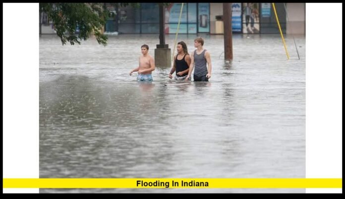

Flooding in Indiana remains a major emergency on Saturday, August 15, with the White River reaching historic levels, evacuations continuing in vulnerable communities, and additional rain creating fresh concerns across central and eastern parts of the state. Officials are urging residents to avoid floodwater and unnecessary travel as river levels remain elevated and several flood warnings stay active.
The latest developments show that this is not a routine summer flooding event. The White River has surpassed records that stood for more than a century at multiple locations. Communities along the river are dealing with flooded neighborhoods, closed roads, emergency evacuations and water rescues.
Conditions are still changing. Some locations have already seen river levels peak, while downstream communities are waiting for the highest water to arrive. Additional thunderstorms could also slow the recovery process.
Historic White River Levels Change the Situation
The White River is at the center of the current emergency.
At Anderson, the river reached 24.93 feet on Friday, breaking the previous record of 23.6 feet established during the Great Flood of 1913. That record had remained in place for 113 years.
The river also reached a record level at Noblesville. The gauge there climbed above the 1913 benchmark, with the river reaching nearly 24 feet early Saturday.
Those numbers are especially significant because the 1913 flood had long served as a historic reference point for the White River. The current event has now exceeded that benchmark at more than one location.
The record-setting levels have affected communities from east-central Indiana toward the Indianapolis area.
Water moving downstream also means that conditions can remain dangerous even after rainfall decreases in upstream communities. River flooding does not always peak at the same time throughout a watershed.
That is why emergency officials continue to warn residents not to assume the danger has passed simply because the heaviest rain has ended.
Indianapolis Faces a Serious River Flood Threat
Indianapolis is now dealing with the downstream effects of the historic rise.
The White River at Ravenswood is expected to reach a level far above its established flood stage. The National Weather Service has issued major flood forecasts for the area, with river levels expected to remain above flood stage for several days.
The forecast has prompted urgent action in communities close to the river.
Residents in Rocky Ripple and Ravenswood have been strongly advised to evacuate. Portions of Broad Ripple have also faced protective measures because of the rising water.
Indianapolis officials declared a local disaster emergency as the river approached dangerous levels in Marion County.
The city has also used its floodgate system in Broad Ripple to help protect vulnerable areas. The system is designed to limit the movement of river water into a protected section of the community.
Officials have stressed that residents should not return to evacuated areas until authorities determine that it is safe.
Floodwater can remain dangerous after a river reaches its peak. Fast-moving water can damage roads, undermine structures and create hidden hazards that are difficult to see from the surface.
Rocky Ripple and Ravenswood Residents Urged to Leave
Rocky Ripple is among the Indianapolis-area communities facing particularly high flood exposure.
The neighborhood sits close to the White River, making it vulnerable as water levels rise.
Residents have been working to protect properties with sandbags while emergency officials monitor the river. Evacuation guidance has also been issued as the river approaches levels that could threaten homes and roads.
Ravenswood is another major concern.
The National Weather Service has projected major flooding along the White River near Ravenswood. The flood warning is expected to remain active well beyond the initial river crest.
That extended period matters because flood conditions can continue even when the river begins to slowly decline.
Residents who have already left vulnerable areas are being urged to remain away until officials provide an all-clear.
Emergency responders also need clear access to flooded neighborhoods. Unnecessary travel can place both residents and rescue crews at risk.
Hamilton County Deals With Historic Flooding
Hamilton County is experiencing one of the most serious phases of the current emergency.
County officials declared a state of emergency as the White River approached record territory around Noblesville.
The river ultimately exceeded the previous record at the Noblesville gauge.
Flooding has affected roads, homes and communities along the river. More than 60 roads have been closed across the county as officials respond to dangerous water conditions.
Emergency personnel have also assisted families with evacuations in areas affected by rising water.
Riverwood, north of Noblesville, has experienced significant flooding. Some homes have been surrounded or affected by water as the river moved beyond its banks.
Officials continue to emphasize that the situation remains active even after the river reaches its highest point.
Additional rainfall can add water to the watershed and delay the decline in river levels.
Residents have also been encouraged to conserve and maintain access to safe drinking water during the emergency period.
Fishers and Noblesville Remain on Alert
The flooding has also affected communities around Fishers and Noblesville.
Because these communities sit along or near the White River, rising water can affect residential areas, roads, parks and other infrastructure.
Emergency crews have continued responding to calls in areas threatened by floodwater.
Some residents have voluntarily evacuated, while officials have taken additional steps in locations where water poses a greater risk.
Road closures are particularly important because flooded streets can become impassable with little warning.
Officials have urged people to stay away from flooded areas so emergency workers can continue their response.
The White River has begun to recede at some locations, but that does not mean every community downstream has passed its peak.
Water continues to move through the river system.
Read More – Indianapolis Weather Update: Storms Roll In This Weekend
Anderson Set a New Flood Record
Anderson experienced one of the most dramatic developments during the current emergency.
The White River reached 24.93 feet at the Anderson gauge on Friday. That exceeded the previous record of 23.6 feet from 1913.
The record flood has caused significant damage and displacement.
Officials have reported widespread effects on homes and businesses, while emergency responders have worked to assist residents in affected areas.
The record is important because the 1913 level had remained the highest recorded stage at the location for more than a century.
The current flood has therefore changed the historical record for the White River at Anderson.
Water from Anderson then moved downstream toward communities including Noblesville and Indianapolis.
That downstream movement explains why communities can experience worsening conditions hours after the original storm has moved away.
Muncie Experienced Major River Flooding
Muncie has also faced serious flooding along the White River.
The river rose well above its normal level and reached its highest point in decades.
Flooding affected roads and areas close to the river, while emergency officials monitored neighborhoods as water levels increased.
The Muncie area experienced its major rise before the record-setting crest reached Anderson and then moved farther downstream.
This sequence has made the current event particularly challenging for emergency planners.
A river system can create a chain reaction.
Heavy rainfall upstream raises water levels. That water then travels downstream, increasing the threat for communities that may not have received the same amount of rainfall.
Residents therefore need to pay attention to river forecasts as well as local rainfall totals.
Eastern Indiana Has Suffered Severe Flood Damage
The current emergency extends beyond the Indianapolis metropolitan area.
Eastern Indiana communities have experienced some of the most visible flood damage during the event.
Cambridge City in Wayne County was particularly hard hit. Floodwater covered portions of the community, forcing emergency responders to conduct water rescues.
Residential areas were inundated as water rose rapidly.
Images and video from the area showed streets and properties surrounded by deep floodwater.
Other communities in the region have also experienced flooded roads and neighborhoods.
The widespread nature of the damage highlights how several rounds of heavy rain can overwhelm communities across a large area.
Eastern Indiana has also dealt with the effects of storms that repeatedly moved over the same general region.
When rainfall falls on already saturated ground, much more water reaches streams and rivers instead of soaking into the soil.
That can quickly turn heavy rain into a major flooding problem.
Additional Rain Could Make Conditions Worse
The emergency is not limited to water that has already accumulated.
Additional thunderstorms remain possible across parts of Indiana, creating a renewed risk of flash flooding.
The ground in many affected areas is already saturated.
That means even a relatively short period of intense rainfall can produce rapid runoff.
Rain falling directly into swollen rivers can also delay the recovery process.
This is especially concerning for communities where the river has already reached or exceeded historical records.
Residents should therefore continue monitoring official warnings even if skies temporarily clear.
A break in rainfall does not automatically mean that flooding has ended.
Flood Warnings Remain Active Across Indiana
Multiple river locations remain under flood warnings.
The latest National Weather Service information includes warnings for sections of the White River at Indianapolis, Elliston, Nora, Ravenswood, Noblesville, Anderson, Muncie and Edwardsport.
Additional warnings cover other rivers and waterways across the state.
The severity varies by location.
Some locations face moderate flooding, while major flooding remains forecast along parts of the White River.
The warnings can also remain active for several days because rivers respond more slowly than roads and drainage systems.
Residents near waterways should monitor their specific location rather than relying on conditions in a neighboring community.
Flooding can vary dramatically over relatively short distances.
Indiana Officials Continue Emergency Operations
Gov. Mike Braun declared a statewide disaster emergency after the severe weather and flooding intensified.
The Indiana National Guard has been mobilized to assist with emergency operations, including water rescues.
The state has also requested federal assistance as communities assess the scale of the damage.
Local governments are handling evacuations, road closures, emergency response and other immediate needs.
The response is occurring at several levels because the flooding has affected multiple counties and river systems.
Emergency officials continue to coordinate as water levels change.
Residents should follow instructions issued by their county, city or emergency management agency.
Those instructions can change quickly when river forecasts are updated.
Travel Remains Dangerous in Flooded Areas
Travel is one of the biggest concerns during the current emergency.
Flooded roads may appear safe but contain hidden dangers.
Water can conceal washed-out pavement, debris, open drainage areas and other damage.
Moving water can also push vehicles off roads.
Drivers should never pass through barricades or attempt to cross a flooded roadway.
A road that was open earlier in the day can become dangerous after another round of rain.
Travel advisories remain particularly important around Indianapolis, Hamilton County and other communities along the White River.
People who do not need to travel should stay away from affected areas and allow emergency crews to work.
Why River Flooding Can Continue After the Crest
One of the most important facts for residents is that a river crest does not mean the emergency ends immediately.
A crest marks the highest point of the river at a particular location.
Afterward, water generally begins to fall, but the decline can take much longer than the rise.
Floodwater can continue moving downstream while other parts of the watershed receive additional rain.
This explains why one community may begin seeing improvement while another community farther downstream is still preparing for its highest water level.
The White River is demonstrating that pattern during the current event.
Some upstream locations have already peaked, while the Indianapolis area continues preparing for major flooding.
What Residents Should Do Right Now
Residents in areas affected by rising water should take official warnings seriously.
Important steps include:
- Leave immediately when officials issue an evacuation order.
- Avoid roads covered by water.
- Never drive around a barricade.
- Stay away from rivers, creeks and fast-moving water.
- Keep phones charged for emergency alerts.
- Take pets with you when evacuating.
- Do not enter a flooded home until authorities say it is safe.
- Keep children away from floodwater.
- Follow local instructions regarding shelters and evacuation routes.
- Avoid unnecessary travel in affected communities.
People who have already evacuated should not return simply because water appears to be falling.
Officials need time to inspect roads, bridges, utilities and buildings before declaring an area safe.
The Recovery Will Take Time
The immediate focus remains protecting lives and keeping emergency crews available.
After the water falls, communities will begin assessing damage to homes, businesses, roads and public infrastructure.
Some roads may remain closed even after floodwater disappears.
Floodwater can damage foundations and electrical systems, leaving properties unsafe.
Residents returning home may therefore face hazards that are not immediately visible.
Local officials will determine when individual areas can safely reopen.
The recovery process will also depend on how much additional rain falls during the next several days.
Latest Situation Across the State
As of Saturday, August 15, the situation remains active across central and eastern Indiana.
The White River has broken long-standing records at Anderson and Noblesville. Indianapolis and nearby communities are preparing for major flooding, while Hamilton County remains under a state of emergency.
Flood warnings remain active across numerous river locations.
Eastern communities have already experienced serious damage and water rescues.
Additional thunderstorms could create new flooding problems before river levels fully decline.
For residents, the most important message is to remain alert and follow local emergency instructions.
The historic river levels also demonstrate how quickly conditions can change during a prolonged rainfall event.
Stay alert, follow local safety instructions, and share your latest local update in the comments to help others stay informed.