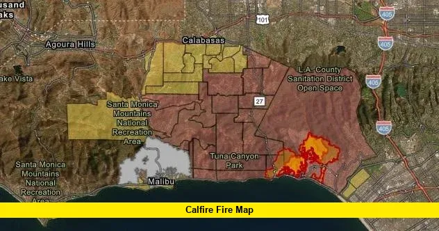

California’s fire season is in full swing, and residents across the state are turning to the CalFire fire map to stay ahead of fast-moving wildfires. With hot, dry conditions gripping much of the state, dozens of active incidents are currently burning from Lassen County to Inyo County. Here’s a complete, up-to-date breakdown of what the CalFire fire map is showing right now, how to use it, and what to do if a fire is burning near you.
╔════════════════════════════════════════════════════════════════════╗ ║ – The Biscar Fire in Lassen County is currently the largest active fire, at ~40,000 acres. ║ ║ – CAL FIRE reports 3,750 wildfires and 144,204 acres burned statewide so far in 2026. ║ ║ – Low snowpack and sustained heat have fueled an unusually active fire season. ║ ║ – The Elephant Fire (Sierra County) and 3-1 Pit Fire (Lassen County) are both nearing full containment. ║ ║ – CAL FIRE’s outlook shows above-normal fire potential continuing through September. ║ ╚════════════════════════════════════════════════════════════════════╝
What Is the CalFire Fire Map?
The CalFire fire map is an interactive, real-time tool maintained by the California Department of Forestry and Fire Protection (CAL FIRE). It tracks every wildfire of 10 acres or larger burning across the state, along with evacuation orders, evacuation warnings, air assets, red flag warnings, smoke and haze forecasts, and recent fire perimeters. The map is updated frequently throughout the day as new information comes in from incident commanders on the ground.
You can access the official CalFire fire map directly at fire.ca.gov/incidents, where it displays current statistics alongside a searchable list of every active incident.
Current CalFire Statistics as of Late July 2026
As of this week, CAL FIRE is reporting a significant year already:
- Total emergency responses: 339,239
- Total wildfires recorded: 3,750
- Acres burned statewide: 144,204
- Fatalities: 0
- Structures destroyed: 55
These numbers reflect the cumulative impact of California’s 2026 fire season, which has been fueled by extreme summer heat and one of the lowest snowpack totals in recent years, leaving mountain vegetation critically dry heading into peak fire months.
Largest Active Fires Right Now
Several fires are currently burning across Northern and Southern California. The largest and most significant include:
- Biscar Fire (Lassen County) – Started July 18, 2026, and has burned approximately 40,000 acres with 5% containment, making it by far the largest active fire in the state right now.
- Elephant Fire (Sierra County) – Ignited July 11, 2026, and has charred roughly 13,926 acres. Firefighters have made strong progress, reaching 92% containment.
- Rock Fire (Inyo County) – A newer fire that started July 20, 2026, already covering about 5,500 acres with containment at just 5%.
- 3-1 Pit Fire (Lassen County) – Burning since July 7, 2026, this fire has scorched 1,055 acres and is nearly wrapped up at 95% containment.
- Loomis Fire (Lassen County) – Started July 11 and has burned 656 acres, with containment at 80%.
Smaller but still active incidents include the Brook Fire in Shasta County, the Rumsey Fire in Colusa County, the Wagon Fire in Lassen County, the Little Fire in Alameda County, the Williams Fire in Monterey County, the Rider Fire in Riverside County, and several others burning under 100 acres, including the Miners, Chute, Pine, Sapphire, Columbus, and Woods fires.
Why Fires Are Spreading Quickly This Year
California entered the summer with a snowpack far below average, drying out vegetation earlier than usual. Combined with sustained above-normal temperatures, this has created conditions ripe for rapid fire growth. Lassen County in particular has emerged as a hotspot, with multiple large fires — the Biscar, Elephant, 3-1 Pit, Loomis, and Wagon fires — all burning simultaneously in the region.
CAL FIRE’s seasonal outlook indicates that significant fire potential will likely remain above normal across mountainous areas and the upper Sacramento Valley through September, before conditions ease closer to normal in October. Southern California is expected to see above-normal temperatures continue through September as well, though increased monsoonal moisture could bring some relief in the form of thunderstorm activity.
How to Read the CalFire Map Legend
When checking the CalFire fire map, it helps to understand the icons and color codes used:
- Active Incident – A fire that is currently burning and not yet contained
- Contained Incident – A fire where containment lines have been established
- Evacuation Order – An immediate threat to life; residents must leave immediately
- Evacuation Warning – A potential threat; those needing extra time or with pets/livestock should leave early
- Red Flag Warning – Conditions of high heat, low humidity, and strong wind that raise fire danger
- Incident Perimeter – The generalized boundary of the fire (structures inside aren’t necessarily damaged)
The map also includes optional layers for air assets, lightning activity, prescribed fires, five-year fire history, and smoke and haze forecasts, which are useful for tracking both fire behavior and air quality impacts.
How to Stay Safe During Active Wildfires
If you live in or near a wildfire-prone area, CAL FIRE recommends:
- Monitoring the official fire map and signing up for CAL Alerts for real-time notifications
- Having a household evacuation plan ready at all times during fire season
- Never waiting for an official order if you feel unsafe — leaving early is always the safest option
- Keeping an emergency go-bag with essentials, medications, and important documents
- Following local radio and official CAL FIRE channels rather than unverified social media posts for evacuation instructions
Frequently Asked Questions
Is the CalFire map updated in real time? The map is updated frequently throughout the day as new information is confirmed by incident commanders, though CAL FIRE notes that updates cannot be guaranteed on a fixed schedule during active emergencies.
What counts as an active incident on the CalFire map? Generally, any wildfire of 10 acres or larger is displayed. Smaller fires that are contained quickly are typically not listed unless they cause significant impact.
Where can I find the official CalFire incident data? Raw incident data is available to developers through CAL FIRE’s CSV, JSON, and GeoJSON APIs linked directly on the official incidents page.
Which is the largest fire burning in California right now? As of this week, the Biscar Fire in Lassen County is the largest active fire, having burned approximately 40,000 acres with containment still in the early stages.
What should I do if an evacuation warning is issued for my area? Begin preparing immediately — gather essentials, plan your route, and be ready to leave. Those with pets, livestock, or mobility needs should leave as soon as a warning is issued rather than waiting for a mandatory order.
Stay alert, stay prepared, and keep checking back — we’ll keep this page updated as new fires ignite and existing ones progress toward containment.