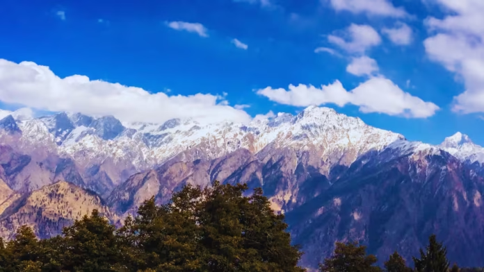

The strongest early November mountain snow risk in the United States is expected across parts of the Central Rockies, Cascades, Klamath Mountains, and northern Sierra Nevada, according to the latest National Weather Service outlook. The first week of November 2026 could bring several rounds of precipitation to the West, with higher elevations facing an increased chance of accumulating snow, difficult driving conditions, and rapidly changing mountain weather.
For travelers, ski enthusiasts, residents of mountain communities, and drivers crossing high-elevation highways, the developing weather pattern is an important signal to prepare for early-season winter conditions. However, the forecast identifies areas of elevated risk rather than guaranteeing heavy snowfall at every mountain location.
Early November Mountain Snow Risk: Latest Forecast at a Glance
- November 1–2: Parts of the Central Rockies could experience heavy mountain snow, particularly at higher elevations.
- November 1–7: The broader western U.S. could experience periods of significant precipitation as Pacific weather systems move inland.
- November 4–7: Parts of the Cascades, Klamath Mountains, and northern Sierra Nevada face a risk of heavy snow.
- Mountain travel: Snow-covered roads, icy patches, reduced visibility, and strong winds could create localized hazards.
- Forecast uncertainty: Snow levels and accumulations will depend on storm timing, elevation, and temperatures.
These timing windows reflect the latest available federal hazards outlook and may change as forecasters receive updated weather-model information.
Which U.S. Mountain Ranges Face the Greatest Snow Risk?

Central Rockies: November 1–2
The Central Rockies are among the first areas to watch as November begins. The latest outlook identifies a slight risk of heavy snow, particularly at the highest elevations.
Forecast guidance indicates a possibility of three-day snowfall exceeding 4 inches, with locally higher totals possible. Lower elevations may receive rain instead, depending on temperatures and the storm’s track.

Cascades: November 4–7
Washington and Oregon’s Cascade Range could see another period of mountain snow as weather systems move toward the Pacific Northwest.
Higher passes may experience accumulating snow, icy surfaces, and reduced visibility. The amount of snowfall will depend on the freezing level and the location of the heaviest precipitation.

Northern Sierra Nevada: November 4–7
The northern Sierra Nevada is another area highlighted for possible heavy snow during the first week of November.
Mountain communities and travelers crossing the Sierra should watch for changes in snow levels. Warm air can bring rain to lower elevations while higher slopes accumulate snow during the same storm.

Klamath Mountains: Early November
Parts of the Klamath Mountains in northern California and southern Oregon are also included in the current heavy-snow risk area.
Elevation differences across this rugged region could produce sharply different conditions over short distances. Drivers should be prepared for wet roads at lower elevations and potentially snowy conditions higher up.
The dates above represent forecast risk periods, not confirmed snowfall events at every destination. Conditions can change as new weather guidance becomes available.
How Much Snow Could Fall in Early November?
Snowfall amounts will vary considerably across the western mountains. The latest federal hazards outlook identifies a possibility of three-day snowfall totals exceeding 4 inches in parts of the Central Rockies, with locally higher amounts possible.
For the Cascades, Klamath Mountains, and northern Sierra Nevada, the forecast highlights a risk of heavy snow but does not provide a single reliable accumulation estimate for every mountain pass or community.
Several factors will determine the eventual totals:
- Elevation: Higher terrain generally has a greater chance of receiving snow rather than rain.
- Storm track: Small changes in a weather system’s path can shift the heaviest precipitation.
- Temperature: Warmer air can raise snow levels and limit accumulation at lower elevations.
- Moisture supply: Pacific moisture can support substantial precipitation when conditions are favorable.
- Storm duration: Longer periods of precipitation can increase accumulation and travel disruption.
Drivers should not interpret a regional heavy-snow outlook as a guarantee of a specific snowfall total for their destination.
Why Is Mountain Snow Possible Even With a Warmer Winter Outlook?
Seasonal forecasts and short-range weather forecasts serve different purposes. A winter outlook describes broad temperature and precipitation patterns over several months, while a hazards outlook identifies shorter periods when particular locations may face disruptive weather.
The developing El Niño pattern is an important part of the broader 2026–27 winter outlook. NOAA has indicated that warmer-than-average seasonal temperatures are favored across portions of the northern United States and western regions, while wetter-than-average conditions are favored across much of the southern United States.
These seasonal patterns do not rule out individual snowstorms.
In the mountains, a single passing storm can produce accumulating snow when temperatures are sufficiently cold, even if the broader seasonal outlook favors warmer conditions. The height of the freezing level is especially important because it helps determine whether precipitation falls as rain or snow at different elevations.
For early November, travelers should therefore prioritize updated local forecasts over assumptions based on the overall winter outlook.
Could Early November Snow Affect Mountain Roads?
Yes. Even a relatively modest snowfall can make mountain driving hazardous when it arrives early in the season.
Road surfaces may become slippery, particularly on shaded stretches, bridges, elevated roadways, and high mountain passes. Drivers may also encounter sudden visibility reductions, strong crosswinds, and rapidly changing conditions as they gain elevation.
Potentially affected travel corridors depend on where the snow develops. Routes crossing the Colorado Rockies, Washington and Oregon Cascades, and Sierra Nevada deserve particular attention when local forecasts indicate accumulating snow.
However, the current outlook does not confirm specific highway closures or mandatory chain restrictions.
Before traveling, motorists should:
- Check the latest forecast for the exact route and destination.
- Review state transportation department alerts for closures and chain requirements.
- Carry appropriate winter equipment and verify tire condition.
- Allow additional travel time and maintain a greater following distance.
- Consider delaying travel if authorities issue warnings or conditions deteriorate.
Mountain weather can change quickly, so checking conditions immediately before departure is more useful than relying on a forecast viewed several days earlier.
Will Early November Snow Improve Ski Conditions?
The developing storm pattern could bring helpful early-season snowfall to selected high-elevation ski areas across the West. The Central Rockies may receive snow at the beginning of November, while parts of the Cascades and Sierra Nevada could see additional opportunities later in the week.
Nevertheless, fresh snowfall does not automatically mean that ski resorts will have adequate coverage or open terrain.
Resort opening dates depend on accumulated snow, temperatures, snowmaking capacity, terrain preparation, and operating decisions. A storm that brings rain to lower elevations may deliver snow to upper mountain terrain without creating suitable conditions across the entire resort.
Skiers should check resort-specific snow reports and opening announcements rather than assume that a regional snow outlook confirms operating conditions.
Early November Mountain Snow Risk: What Happens Next?
The next stage of the forecast will depend on how the Pacific weather systems develop and where their precipitation bands move inland.
The early part of November is expected to bring attention to the Central Rockies, followed by a potential shift toward the Pacific Northwest and northern California mountain ranges. Forecast confidence for exact snowfall amounts, snow levels, and local impacts remains limited this far ahead.
The most useful indicators to watch in updated forecasts are:
- Changes in predicted snow levels.
- Probabilities of accumulating snow at individual elevations.
- Winter weather watches and warnings.
- Expected snowfall totals over 24- to 72-hour periods.
- Mountain-pass road conditions and transportation restrictions.
These details will help distinguish areas likely to receive ordinary early-season snowfall from locations that could experience more disruptive winter weather.
Frequently Asked Questions
Where is the highest mountain snow risk in early November 2026?
The latest outlook identifies parts of the Central Rockies for November 1–2 and portions of the Cascades, Klamath Mountains, and northern Sierra Nevada for November 4–7.
When could heavy mountain snow begin?
The first identified risk period is November 1–2 in the Central Rockies. Additional snow risks are highlighted for the Cascades, Klamath Mountains, and northern Sierra Nevada later in the first week.
How many inches of snow are possible?
The Central Rockies outlook indicates the possibility of three-day totals exceeding 4 inches, with locally higher amounts possible. Specific totals for other mountain ranges remain uncertain and will depend on updated forecasts.
Will Colorado mountain passes receive snow?
Parts of the Central Rockies are included in the current risk outlook. Whether individual Colorado passes receive accumulating snow will depend on elevation, temperatures, and the storm track.
Could California and Oregon see mountain snow?
Yes. Parts of the northern Sierra Nevada and Klamath Mountains are highlighted for potential heavy snow, while the Cascades could experience additional snowfall later in the week.
Will mountain highways close in early November?
No specific closures are confirmed by the regional hazards outlook. Temporary restrictions or closures remain possible if local conditions become dangerous.
Does El Niño mean less snow in the mountains?
Not necessarily. El Niño influences broad seasonal weather patterns, but individual storms can still bring substantial mountain snowfall. Temperature, elevation, and storm timing are critical to the outcome.
Where can travelers find the latest mountain snow warnings?
The National Weather Service provides updated forecasts, watches, and warnings. State transportation departments provide road-condition reports, pass restrictions, and closure information.
Final Outlook
The early November mountain snow risk is an important developing weather story for the western United States. Parts of the Central Rockies could experience heavier snow at the start of the month, followed by potential snow across the Cascades, Klamath Mountains, and northern Sierra Nevada.
The main concern is not simply how much snow falls, but where it accumulates, how low snow levels descend, and whether storms coincide with periods of heavy mountain travel. Residents, drivers, and outdoor enthusiasts should follow local forecasts closely as the first week of November approaches.
The latest outlook signals areas to monitor, not a guarantee of widespread heavy snow. Updated local forecasts will provide a clearer picture of the eventual snowfall totals and potential impacts.