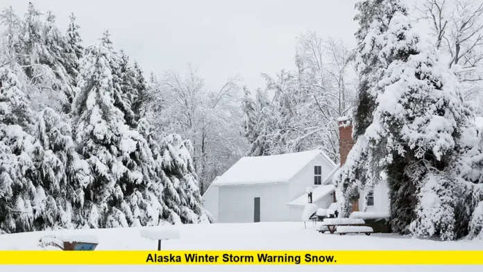

The alaska winter storm warning snow outlook is especially important for residents and travelers in northern and interior Alaska, where heavy snowfall, powerful winds, and blowing snow are creating hazardous winter travel conditions. The latest available National Weather Service alerts indicate that parts of the Brooks Range, Noatak Valley, and Upper Koyukuk Valley are facing significant snowfall, with some warnings extending into Monday, October 26, 2026.
The severity of the weather varies by location. Forecasts for the South Slopes of the Western Brooks Range call for as much as 10 to 20 inches of snow in higher terrain, while the South Slopes of the Central Brooks Range could receive 8 to 16 inches. Strong wind gusts may reduce visibility and make driving particularly dangerous. Residents should check the alert for their exact location before traveling because snowfall totals, warning expiration times, and local conditions can differ considerably.
Latest Alaska Winter Storm Warning and Snowfall Forecast
The current winter weather threat is concentrated in parts of northern and interior Alaska. The National Weather Service has outlined several distinct snowfall zones, with the most substantial accumulations expected across higher terrain in the Brooks Range.
The latest available warning details include the following:
| Area | Forecast snowfall | Wind conditions | Warning outlook |
|---|---|---|---|
| South Slopes of the Western Brooks Range | 10–20 inches in higher terrain | Gusts up to 55 mph | Through Sunday afternoon |
| Noatak Valley | 3–6 inches | Strong winds may cause blowing snow | Through Sunday afternoon |
| Upper Kobuk Valleys | 4–8 inches | Gusts up to 50 mph | Through Sunday afternoon |
| South Slopes of the Central Brooks Range | 8–16 inches | Gusts up to 35 mph | Through Monday evening |
| Upper Koyukuk Valley | 8–12 inches, with a glaze of ice possible | Gusts up to 30 mph | Through Monday evening |
These figures reflect the latest available warning information and are forecast totals for the specified areas, not measurements of snow already on the ground. Actual accumulation can vary with elevation, local temperatures, and the movement of precipitation bands.
Warning expiration times also matter. Some alerts are scheduled to end on Sunday, while others continue into Monday night. Residents should not assume that every part of Alaska is under the same warning or that an alert remains active after its stated expiration time.
Where Is Heavy Snow Expected in Alaska?
South Slopes of the Western Brooks Range
The Western Brooks Range is among the areas facing the greatest forecast snowfall. Higher elevations, including the vicinity of Red Dog Mine, could receive 10 to 20 inches of snow.
The Noatak Valley has a lower forecast total of approximately 3 to 6 inches. However, strong winds could still make conditions dangerous even where snowfall amounts are smaller.
Wind gusts reaching 55 mph are possible in the warning area. These winds can move loose snow across roads, cover tracks, and sharply reduce visibility. As a result, the practical danger may be considerably greater than snowfall totals alone suggest.
Travelers should avoid unnecessary journeys through exposed areas while heavy snow and blowing snow are occurring. People who live in the affected communities should also prepare for difficult local travel and possible delays in transportation.
Upper Kobuk Valleys
The Upper Kobuk Valleys, including the communities of Ambler, Kobuk, and Shungnak, are also included in the latest available winter storm warning information.
Forecast snowfall ranges from 4 to 8 inches, with wind gusts potentially reaching 50 mph. This combination can produce blowing snow and make it difficult for drivers to distinguish the roadway from surrounding terrain.
Even moderate snowfall can become a serious travel problem when strong winds repeatedly move snow across open ground. Residents should allow additional time for essential journeys and reconsider travel if visibility deteriorates.
The warning information available for this area places the expected end of the alert on Sunday afternoon. Updated local forecasts are important because the situation may change as the storm moves through the region.
South Slopes of the Central Brooks Range
The Central Brooks Range faces a longer period of hazardous winter weather. The latest available forecast calls for 8 to 16 inches of snow, with wind gusts reaching approximately 35 mph.
The affected area includes Wiseman, Coldfoot, Chandalar DOT Camp, Iniakuk Lake, and portions of the Dalton Highway between mileposts 165 and 232.
Unlike areas where most of the snowfall is expected in a single period, this system is forecast to produce two waves of snow.
The first round is expected to continue into Sunday morning, bringing approximately 4 to 8 inches. Lighter snowfall is anticipated during part of Sunday afternoon and Sunday night, followed by another period of heavier snow on Monday.
That second round could add another 4 to 8 inches. The extended period of snowfall means that road conditions may remain difficult even if the weather temporarily improves between the two rounds.
Drivers using the Dalton Highway should check road conditions before departing and should be prepared for changing visibility, snow-covered surfaces, and delays.
Upper Koyukuk Valley
The Upper Koyukuk Valley is another area where heavy snow and icy conditions are a concern. Communities included in the warning area include Allakaket, Bettles, Alatna, and Evansville.
The latest available forecast calls for 8 to 12 inches of snow, a possible glaze of ice, and wind gusts of up to 30 mph.
Snow is expected during the first part of the event, with lighter precipitation possible for a period before additional winter weather arrives Monday.
Temperatures may rise enough for precipitation to change from snow to rain in some locations. If rain falls onto surfaces that remain below freezing, it can freeze and create a thin, difficult-to-see layer of ice.
This possibility makes the forecast particularly important for anyone planning to travel early next week. Roads can remain slippery even after snowfall decreases.
Why the Alaska Winter Storm Warning Snow Situation Is Dangerous
A winter storm warning indicates that significant winter weather is expected or occurring and that hazardous conditions could affect normal activities. The precise criteria and impacts depend on the location and forecast.
In Alaska, the combination of heavy snow, strong winds, and cold conditions can create several hazards at the same time.
Reduced visibility: Blowing snow can make it difficult to see the road, other vehicles, or nearby landmarks. Visibility can deteriorate rapidly in exposed areas.
Snow-covered roads: Fresh snowfall can cover lane markings and make it harder to judge road edges. Snow-packed surfaces may also reduce tire traction.
Ice formation: Freezing rain or rain falling onto frozen surfaces can produce slick conditions that are difficult to recognize while driving.
Travel delays: Snow removal crews may need additional time to clear roads, especially during persistent snowfall or strong winds. Drivers may encounter slower traffic or temporary disruptions.
Stranding risk: A vehicle that becomes stuck in deep snow or stops working in severe weather can leave occupants exposed to dangerous conditions.
These hazards do not affect every community equally. A location receiving only a few inches of snow may still experience dangerous conditions if winds are strong enough to cause blowing snow.
How the Storm Could Affect Alaska Travel
Travel conditions are a major concern during the current weather event, particularly in remote northern and interior areas.
Roads near mountain passes, exposed valleys, and higher terrain may experience rapidly changing conditions. Drivers should not rely solely on a forecast snowfall total when deciding whether a journey is safe.
Before leaving home, motorists should review the latest road reports and weather alerts for their entire route. A road may be passable at the starting point but hazardous farther along the journey.
Drivers should also consider whether their destination has reliable access to shelter, fuel, food, and emergency assistance. In remote areas, these resources may be separated by considerable distances.
For people who must travel, a winter emergency kit should include:
- Warm clothing, insulated blankets, and extra gloves.
- Drinking water and nonperishable food.
- A flashlight with spare batteries.
- A first-aid kit and essential medications.
- A fully charged phone and a suitable charging device.
- Snow-clearing equipment and other supplies appropriate for the vehicle and route.
A vehicle should be kept in good operating condition before entering an area affected by severe winter weather. Fuel levels, tires, battery performance, and heating systems are especially important.
If a vehicle becomes stranded, occupants should generally remain inside unless staying there presents an immediate danger. They should make themselves visible to rescuers and avoid exhausting their energy by attempting to walk through blowing snow without a safe destination.
Exhaust pipes must also remain clear of snow when the engine is running. A blocked exhaust can allow carbon monoxide to enter the vehicle.
Bering Sea Storm Adds to Alaska’s Weather Concerns
The snowfall warnings are part of a broader period of unsettled weather affecting Alaska. The National Weather Service’s Fairbanks office has also reported a Bering Sea storm bringing heavy precipitation and strong winds to western Alaska.
Coastal communities can face different hazards from those experienced in inland mountain areas. Along the coast, powerful winds, rough seas, and elevated water levels can create additional risks.
Minor to major coastal flooding has been identified as a concern in parts of western Alaska during this weather system. The specific level of risk depends on the affected coastline, local geography, wind direction, and water conditions.
Residents near exposed shorelines should pay attention to coastal flood alerts as well as snow and wind warnings. A winter storm can affect road access, outdoor activities, marine transportation, and community infrastructure at the same time.
People should not assume that an inland snowfall forecast accurately describes conditions along the coast. Separate local forecasts are needed to understand the risks in each area.
What Residents Should Do During the Warning
Preparation is especially important when severe winter weather affects remote communities. Residents should make practical arrangements before conditions deteriorate rather than waiting until travel becomes difficult.
Keep essential supplies indoors, secure outdoor items that could be moved by strong winds, and make sure heating equipment is operating safely. If power interruptions are a concern, have appropriate lighting and backup supplies available.
People who rely on regular deliveries, medical transportation, or other essential services should consider whether weather-related delays could affect their plans.
It is also useful to check on family members, neighbors, and anyone who may need additional assistance during severe weather, provided it can be done safely.
Travel decisions should reflect the latest warning for the exact location. A general Alaska forecast is not a substitute for an alert covering a particular highway, community, or mountain pass.
If officials advise against travel, residents should follow that guidance. Even when no travel restriction has been issued, delaying a nonessential journey may be the safer choice during periods of heavy snow and strong winds.
How to Follow the Latest Alaska Snow and Weather Alerts
Weather warnings can be updated as forecasters receive new observations and revise their predictions. Snowfall totals, wind speeds, and the expected duration of an event can change, so an earlier forecast should not be treated as a permanent assessment of conditions.
The National Weather Service provides location-specific forecasts and active watches, warnings, and advisories. Residents should select their community or exact travel destination rather than relying only on a statewide weather summary.
Alaska’s road-condition information is also important for motorists, particularly those traveling on highways that cross remote or mountainous terrain. Road reports can provide useful information about closures, restrictions, and hazardous driving conditions.
When checking an alert, pay particular attention to four details:
- The affected location: Confirm that the warning covers your community or planned route.
- The expected hazard: Determine whether the main concern is heavy snow, blowing snow, strong winds, freezing rain, or a combination.
- The timing: Review when the warning begins and when it is scheduled to expire.
- The expected impact: Look for information about visibility, difficult travel, ice formation, and other local risks.
An expired warning does not automatically mean every road is safe. Snow removal, drifting, and ice can continue to affect travel after the most intense precipitation has ended.
What to Expect Next From Alaska’s Winter Weather System
The immediate outlook depends on the movement of the storm and the timing of additional precipitation. Some areas in northwestern Alaska are expected to see their current warning period conclude on Sunday, while the Central Brooks Range and Upper Koyukuk Valley face a longer period of potentially hazardous weather into Monday.
The forecast for the Central Brooks Range indicates a second round of heavier snow on Monday after a relative lull. In the Upper Koyukuk Valley, a possible change from snow to rain introduces an additional risk of freezing surfaces.
These differences demonstrate why residents should monitor local forecasts rather than assuming that improving conditions in one part of the state mean the entire weather system has passed.
The latest available information does not establish that all of Alaska is under a winter storm warning. The alerts apply to designated areas, and other communities may have different forecasts or separate weather hazards.
Anyone planning to drive, work outdoors, or travel through remote terrain should review current conditions immediately before leaving.
Final Thoughts
The latest alaska winter storm warning snow information points to significant snowfall and strong winds across parts of northern and interior Alaska, with higher terrain in the Western Brooks Range facing some of the largest projected accumulations. The Central Brooks Range and Upper Koyukuk Valley may continue to experience hazardous conditions into Monday, October 26.
The main concerns are reduced visibility, difficult road conditions, and the potential for ice where precipitation changes form. Checking current local alerts, preparing an emergency kit, and postponing unnecessary travel can help residents respond more safely as conditions evolve.
Share your local weather experience in the comments and stay updated on changing Alaska snow forecasts and winter storm warnings.