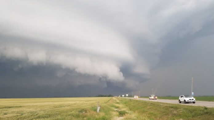
On the night of June 28, 2025, Minnesota tornado warnings echoed through the Twin Cities, sending residents scrambling for safety as sirens blared and power outages swept the region. Severe storms tore through central and southern Minnesota, spawning multiple tornadoes and leaving a trail of damage. The National Weather Service issued urgent alerts, with tornado warnings covering areas from Shakopee to Minneapolis. This article dives into the latest developments, capturing the intensity of the storms and their impact on the Twin Cities metro area.
A Night of Chaos: Minnesota Tornado Warnings Unfold
Late Saturday night into early Sunday, June 29, 2025, the Twin Cities faced a barrage of severe weather. Sirens blared across neighborhoods like Northeast Minneapolis, Waconia, and St. Bonifacius as the National Weather Service issued multiple Minnesota tornado warnings. Five Doppler-confirmed tornadoes touched down in Carver County alone, with reports of twisters in Victoria, Waconia, Cologne, and St. Bonifacius. These storms moved swiftly, with one observed tornado over Waconia traveling east at 30-35 mph. Heavy rainfall and damaging winds compounded the chaos, leading to downed trees and power lines.
The storms didn’t spare infrastructure. In Victoria, trees blocked Highway 7, and thousands of homes lost power. Xcel Energy reported over 2,500 customers affected in the Twin Cities metro. While the tornado warning for Hennepin County expired at 1 a.m., severe thunderstorm warnings lingered, signaling ongoing risks. Residents took to social media, sharing videos of ominous clouds and debris, painting a vivid picture of the storm’s ferocity.
Key Impacts of the Minnesota Tornado Warnings
| Aspect | Details |
|---|---|
| Location | Twin Cities metro, including Carver, Hennepin, Scott, and Dakota counties |
| Tornadoes | Five confirmed in Carver County (Victoria, Waconia, Cologne, St. Bonifacius) |
| Warnings | Issued from 9:57 p.m. Saturday to 1 a.m. Sunday, June 29, 2025 |
| Damage | Downed trees, blocked roads (e.g., Highway 7), power outages affecting thousands |
| Sirens | Activated in multiple areas, including Northeast Minneapolis |
| Weather Hazards | Heavy rain, damaging winds, potential for flash flooding |
Power Outages and Community Response
As Minnesota tornado warnings dominated the night, power outages left thousands in the dark. Xcel Energy’s outage map showed significant disruptions, particularly in the Twin Cities metro. The storms’ high winds snapped utility poles, and officials warned that some outages could last days. In response, communities rallied to clear debris and ensure safety. Emergency services in Carver County activated outdoor warning sirens, urging residents to seek shelter in basements or interior rooms without windows.
Local authorities emphasized preparedness. Minneapolis officials advised residents to secure outdoor items and keep NOAA weather radios handy. Social media posts captured the community’s resilience, with residents sharing tips on staying safe and reporting damage. The storms’ intensity prompted some to seek shelter in ditches or sturdy buildings, following National Weather Service guidelines.
Ongoing Risks and Safety Measures
The Minnesota tornado warnings highlighted the region’s vulnerability to severe weather. While the Twin Cities metro avoided significant structural damage, the threat of flash flooding loomed due to heavy rainfall. Forecasters noted that storms could stall, increasing flood risks in low-lying areas. The National Weather Service urged residents to stay vigilant, as additional storms were possible through Sunday morning.
Safety measures took center stage. Carver County’s Emergency Management team reminded residents that sirens signal immediate danger, not an all-clear. They encouraged signing up for the Carver County Citizen Alert System for real-time updates. Meanwhile, meteorologists like Ian Leonard from FOX 9 provided live updates, emphasizing the need for multiple alert methods, including mobile apps and weather radios.
Key Points Summary
- Tornado Activity: Five confirmed tornadoes in Carver County, with warnings across the Twin Cities metro.
- Power Outages: Over 2,500 customers affected, with potential for prolonged outages.
- Community Action: Sirens activated, residents urged to seek shelter, and emergency services mobilized.
- Ongoing Threats: Heavy rain and potential flooding risks persisted into Sunday, June 29, 2025.
Looking Ahead: Preparing for Future Storms
As the Twin Cities recover from the latest Minnesota tornado warnings, attention turns to preparedness. Minnesota averages 46 tornadoes annually, with peak activity from May to August. The June 28-29 storms underscore the importance of readiness. Residents are encouraged to review emergency plans, stock up on batteries, and charge devices. The National Weather Service’s Severe Weather Awareness Week, held earlier in April 2025, drilled these lessons through statewide tornado exercises.
The storms also sparked discussions on social media, with users posting dramatic footage of rotating clouds and downed trees. These real-time updates, shared on platforms like Instagram and YouTube, helped spread awareness and keep communities informed. As Minnesota braces for potential future storms, staying connected to reliable weather sources remains critical.
Stay Safe and Informed
Minnesota’s severe weather season is far from over. To stay safe, download weather apps like FOX 9 Weather, sign up for local alert systems, and keep a NOAA weather radio on hand. Check your emergency kit and review shelter plans with your family. For the latest updates on Minnesota tornado warnings, follow trusted sources like the National Weather Service and local meteorologists. Stay vigilant, and be ready to act if sirens blare again.
