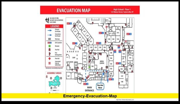

When a wildfire threatens homes and communities, one of the most valuable resources available to residents is a fire evacuation map. These maps provide real-time information about evacuation zones, road closures, and areas under evacuation orders or warnings, helping people make informed decisions during rapidly changing emergencies.
As wildfire activity continues in many parts of the United States, emergency management agencies are relying on digital mapping tools to communicate critical safety information quickly and accurately.
Key Points Summary
╔════════════════════════════════════════════════════════════════════╗
║ – A fire evacuation map shows current evacuation orders, warnings, and affected areas. ║
║ – Local emergency agencies regularly update evacuation maps during active wildfires. ║
║ – Maps help residents identify safe evacuation routes and restricted zones. ║
║ – Evacuation status can change rapidly as fire conditions evolve. ║
║ – Residents should always follow official emergency alerts alongside evacuation maps. ║
╚════════════════════════════════════════════════════════════════════╝
What Is a Fire Evacuation Map?
A fire evacuation map is an interactive or printable map created by emergency management agencies to display areas affected by an active wildfire. It identifies neighborhoods under evacuation orders, evacuation warnings, and areas that remain outside the immediate danger zone.
These maps are updated as fire behavior changes, allowing residents to understand the latest emergency conditions in their communities.
Why Fire Evacuation Maps Are Important
Wildfires can spread quickly due to wind, dry vegetation, and changing weather conditions. A fire evacuation map helps people understand whether they should leave immediately, prepare to leave, or remain alert for changing conditions.
Emergency officials use these maps to reduce confusion by clearly identifying evacuation boundaries and approved travel routes.
Using an official evacuation map can also help first responders manage traffic and keep evacuation operations organized.
Understanding Evacuation Levels
Most fire evacuation maps use color-coded zones to indicate different evacuation statuses. While colors and terminology may vary by jurisdiction, they generally include:
- Evacuation Order: Residents must leave immediately because there is an immediate threat to life.
- Evacuation Warning: People should be prepared to leave at short notice if conditions worsen.
- Normal Status: No evacuation is currently in effect, but residents should continue monitoring updates.
Always check the legend on the official evacuation map for the specific meanings used by your local emergency agency.
Information Typically Found on a Fire Evacuation Map
Modern evacuation maps often include much more than evacuation zones. They may display:
- Active wildfire perimeters
- Evacuation orders and warnings
- Road closures
- Emergency shelters
- Traffic restrictions
- Fire incident boundaries
- Community evacuation zones
- Public safety checkpoints
Many maps also allow users to search by home address to determine whether their property is affected.
How Often Are Fire Evacuation Maps Updated?
During active wildfire incidents, evacuation maps may be updated several times throughout the day.
Updates depend on:
- Fire growth
- Weather conditions
- Wind direction
- Firefighter assessments
- New evacuation decisions
Because conditions can change rapidly, residents should check official updates frequently rather than relying on older screenshots or shared social media posts.
How to Use a Fire Evacuation Map Effectively
To get the most benefit from a fire evacuation map:
- Search for your home address if the feature is available.
- Identify your evacuation zone.
- Review nearby evacuation routes.
- Monitor neighboring evacuation areas.
- Watch for changes throughout the day.
- Follow official emergency instructions even if your area has not yet been ordered to evacuate.
Preparing in advance can save valuable time if evacuation becomes necessary.
What to Do If Your Area Is Under an Evacuation Order
If officials issue an evacuation order for your neighborhood:
- Leave immediately.
- Follow designated evacuation routes.
- Bring essential medications, identification, and emergency supplies.
- Take pets if possible.
- Inform family members of your destination.
- Do not attempt to return until authorities declare the area safe.
Ignoring evacuation orders can place both residents and emergency responders at greater risk.
Common Mistakes to Avoid
During wildfire emergencies, people sometimes rely on unofficial information. To stay safe:
- Do not depend solely on social media rumors.
- Avoid driving into closed areas.
- Do not assume neighboring communities have the same evacuation status.
- Continue checking official updates even after evacuating.
Using verified information helps reduce confusion during rapidly evolving situations.
Fire Evacuation Maps and Community Preparedness
Communities that understand how to use evacuation maps are often better prepared for wildfire emergencies.
Local governments encourage residents to:
- Know their evacuation zone.
- Sign up for emergency alerts.
- Prepare an emergency kit.
- Plan multiple evacuation routes.
- Stay informed throughout wildfire season.
Preparedness before an emergency can make evacuation safer and more efficient.
Latest Guidance
Fire evacuation maps remain one of the most important public safety tools during wildfire incidents. Because evacuation areas can expand or shrink as firefighters gain control of a blaze, residents should regularly consult official emergency resources and follow instructions issued by local authorities.
Using the latest evacuation information can help protect lives, reduce travel delays, and support emergency response efforts.
Q: What is a fire evacuation map?
A: It is a map showing evacuation orders, warnings, wildfire boundaries, and other emergency information during an active fire.
Q: Who creates fire evacuation maps?
A: Local emergency management agencies, fire departments, and public safety officials typically produce and update them.
Q: How often are evacuation maps updated?
A: During active incidents, updates may occur multiple times each day as conditions change.
Q: What is the difference between an evacuation order and a warning?
A: An order means residents should leave immediately, while a warning means they should prepare to evacuate if conditions worsen.
Q: Can evacuation zones change?
A: Yes. Fire behavior can change rapidly, and officials may expand, reduce, or lift evacuation zones as needed.
Q: Should I rely on social media for evacuation information?
A: No. Always verify information through official emergency management agencies and local authorities.
Q: What should I bring if I evacuate?
A: Essential documents, medications, emergency supplies, important personal items, and pets whenever possible.
Q: Why should I check the map regularly?
A: Wildfire conditions can change quickly, and evacuation boundaries may be updated throughout the day.
Stay informed by checking official fire evacuation updates regularly, and share this guide with friends and family to help everyone stay prepared during wildfire emergencies.