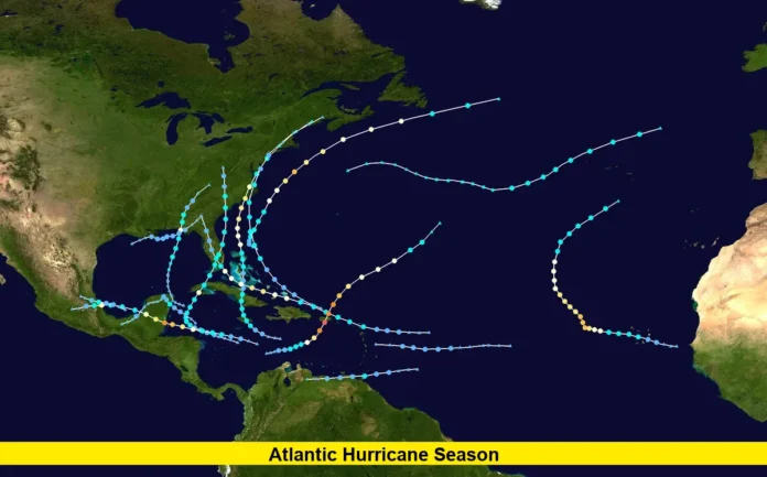
The Atlantic hurricane season is showing signs of intensifying as forecasters track the potential for the first hurricane of 2025. This development could influence Florida’s weather in the coming days, bringing heightened risks of rain, strong winds, and dangerous surf along the coast.
Experts continue to project an above-average season, with 13–18 named storms expected, including 5–9 hurricanes and 2–5 major hurricanes. The likelihood of an above-normal season stands at 50%, making the next few weeks critical for monitoring storm activity.
Signs of intensifying activity
Multiple tropical disturbances are now on the radar, signaling that the peak of the season is approaching.
- A tropical wave moving westward from Africa has a 60% chance of developing into a named storm. Current tracking suggests a northwest path into the Atlantic.
- A disturbance near the Southeast U.S. coast has a 30% chance of tropical development. Even without full formation, it could deliver heavy rain and flash flooding to Florida.
- Tropical Storm Dexter, the fourth named storm this year, formed off the Carolina coast and is moving away from land, but it highlights the ramp-up in storm activity.
What this means for Florida’s weather
If either the tropical wave or the coastal disturbance develops further, Florida could face several weather impacts:
Read Also-Tropical Storms Atlantic: Activity Building as Hurricane Season Peaks
- Heavy rainfall with localized flash flooding, especially in low-lying coastal areas.
- Increased wave action and rip current risks along the Atlantic shoreline.
- Gusty winds capable of causing scattered power outages and minor property damage.
The state’s vulnerability is elevated as the season moves into its most active stretch, which typically spans from mid-August to mid-October.
Climatological context and historical comparison
The first named storm of the year, Tropical Storm Andrea, formed on June 24, which was nearly a week later than the seasonal average. It was also the latest “A-storm” since 2014. Andrea remained over open waters and quickly dissipated, but the quiet start has little bearing on the months ahead.
Historically, most hurricanes in the Atlantic occur between early August and mid-October. Warm sea surface temperatures, reduced wind shear, and active African easterly waves all contribute to higher storm potential during this time.
Current tropical activity overview
As of today, four named storms have formed this year: Andrea, Barry, Chantal, and Dexter. None have reached hurricane status yet, but conditions are increasingly favorable for intensification.
Table: Key Season Indicators
| Indicator | Status as of Aug 11, 2025 |
|---|---|
| Named storms so far | Four (Andrea, Barry, Chantal, Dexter) |
| Hurricanes | None yet |
| NOAA seasonal forecast | Above-normal likely (50% chance) |
| Active systems being monitored | African wave (60%), coastal system (30%) |
| Florida immediate threat level | Moderate – rain, waves, flooding risk |
Why Florida should stay alert
Even if the season’s first hurricane does not make landfall in Florida, the state often experiences peripheral impacts from passing systems. Heavy rainfall, tropical-storm-force winds, and coastal flooding can occur hundreds of miles from a storm’s center.
Preparedness remains key:
- Keep an updated emergency supply kit.
- Monitor official weather updates daily during the peak season.
- Review evacuation routes and family communication plans.
- Secure outdoor items that could become windborne debris.
Looking ahead
The coming weeks are likely to bring more frequent storm formation as atmospheric and oceanic conditions align. While it is too soon to determine the exact path or strength of the next major system, the likelihood of the first hurricane of the season forming before the end of August is increasing.
Communities in Florida and along the U.S. East Coast should remain vigilant. The combination of warm waters, favorable wind patterns, and active tropical waves makes this a period of heightened risk.
As the Atlantic hurricane season edges toward its peak, the probability of the first hurricane forming is climbing. Florida’s forecast may change quickly, and even storms that remain offshore can bring disruptive weather. Keep watch on the tropics and be ready to act if conditions shift.
