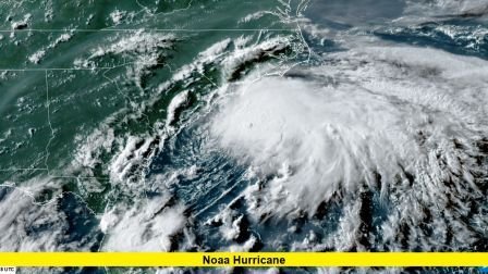
The latest NOAA hurricane forecast highlights an active 2025 Atlantic season as August reaches its peak. Officials now project between 13 and 18 named storms, 5 to 9 hurricanes, and 2 to 5 major hurricanes before the season ends. This updated outlook is slightly adjusted from earlier estimates but still points to above-average activity.
Forecasters cite warm Atlantic and Caribbean waters, along with favorable wind and atmospheric conditions, as key factors fueling the elevated risk. The West African Monsoon remains active, providing consistent waves of moisture and energy into the Atlantic basin.
Currently, two tropical disturbances are under close watch in the Atlantic:
- Invest 97L is positioned just off the coast of West Africa near the Cabo Verde Islands. It has a 70% chance of developing into a tropical depression within 48 hours and a 90% chance over the next week, moving west-northwest.
- Invest 96L is further east in the Atlantic and has a much smaller development window, with only a 10% chance in the next 48 hours and 20% in seven days.
While the Atlantic sees these potential developments, activity in the Pacific is also notable. Hurricane Henriette has formed well north of Hawaii with maximum sustained winds of 80 mph. It is moving northwest and is expected to weaken in the coming days, posing no threat to land. Further east, Tropical Storm Ivo is losing strength west of Baja California and is forecast to become a remnant low soon.
Quick-View Storm Summary
| Basin | System | Status / Outlook |
|---|---|---|
| Atlantic | Invest 97L | 70% development chance in 48h, 90% in 7 days, moving WNW |
| Atlantic | Invest 96L | 10% development chance in 48h, 20% in 7 days |
| Pacific | Hurricane Henriette | 80 mph winds, heading NW, weakening trend |
| Pacific | Tropical Storm Ivo | Weakening, likely to become remnant low soon |
NOAA Hurricane Preparedness Message
As the heart of hurricane season unfolds, NOAA urges coastal communities to stay prepared. Emergency plans, stocked supplies, and awareness of local evacuation routes remain vital. Officials stress that even weak or short-lived tropical systems can produce heavy rainfall, dangerous surf, and flash flooding.
Read also-Tropical Storms Atlantic: Latest Updates as Hurricane Season Peaks
With several weeks of heightened activity ahead, forecasters continue to issue advisories and outlooks multiple times daily. Staying informed is the best defense against fast-changing tropical threats.
As new systems emerge and existing storms evolve, this year’s forecast reinforces the need for vigilance throughout the remainder of the season.
Stay alert, stay safe, and keep monitoring official updates as conditions in both the Atlantic and Pacific basins continue to shift.
